Based on 27 reviews
Trip Duration
15 DaysTrip Difficulty
ModerateMax Altitude:
5,214m. / 17,106ft.Group Size
2 to 25 PeopleBest Season
Autumn, SpringMeals
Breakfast, Lunch and DinnerAccommodation
Teahouse/ Hotel/TentTransportation
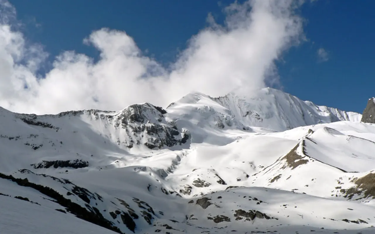
Tourist BusThe Lower Dolpo Trek is culturally diverse and one of the most isolated trekking experiences in Nepal. This is a trek in the western Himalayas, and the trekkers pass through remote valleys, traditional villages, old monasteries, and mountain passes. The trail presents a rare chance to view the untainted beauty of the Dolpo region and to explore the landscapes that have not been transformed by any development yet.
The trek goes through the Shey Phoksundo National Park, which houses the popular Phoksundo Lake, wildlife, and spectacular mountainous views. On the route, the trekkers are exposed to local people who abide by centuries-old customs brought about by Tibetan culture and the Bon religion. Villages like Dho Tarap and Ringmo offer a glimpse into the lives of people who inhabit one of the remotest areas of Nepal.
A designed Lower Dolpo Trek Nepal trip will be a balance between cultural discovery and a satisfying mountain walk. The path traverses mountainous passes, Numa La and Baga La, which also have elevations of 5,000 m / 16,404 ft and provide a glimpse of jagged Himalayan terrain. The trail also follows ancient trade routes that had been used in the past in trade between Nepal and Tibet.
The Lower Dolpo Trek Itinerary normally involves flights to Juphal, off-road trekking tracks, acclimatization, and sightseeing of key cultural and natural sites. The trek is less busy and offers a more serene experience than most of the trekking destinations in Nepal due to its isolated nature and remote location.
In the company of seasoned planning and guidance from 3A Adventure, trekkers will be able to experience a safe and well-planned journey in one of the most interesting trekking areas in the country. The blend of nature, culture and wilderness are all in the wilderness that makes this trek a worthwhile Himalayan experience.
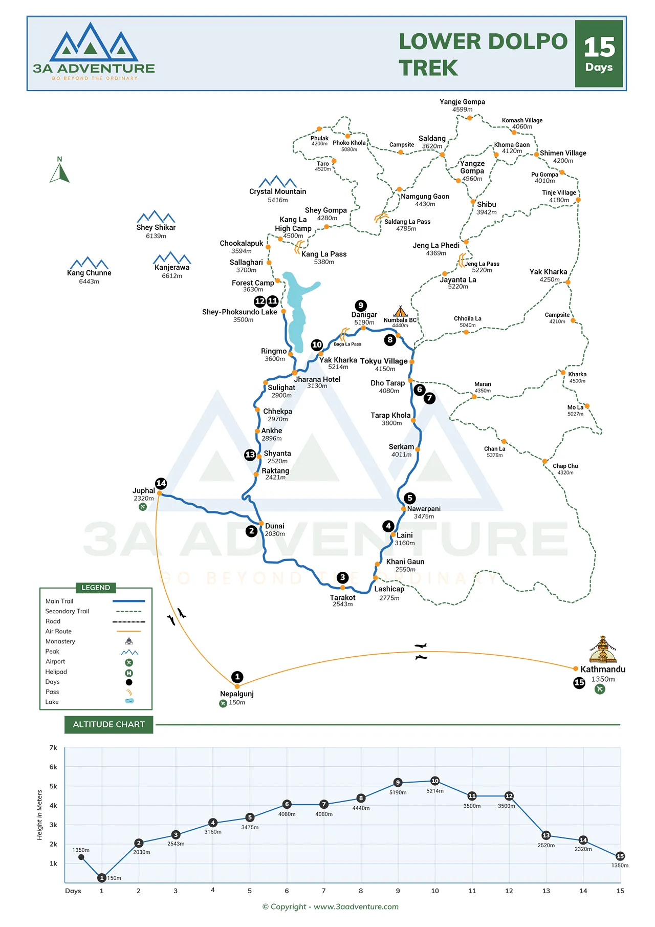
Your adventure starts with a morning in Kathmandu, where you can take breakfast and make final preparations before beginning the adventure. Later in the day, you will change to Tribhuvan International Airport to board a plane to Nepalgunj. This brief flight is a preview of what Nepal has to offer, and, weather permitting, a glimpse of the Himalayan range in the air.
The location of Nepalgunj is in the lowland area of Nepal with an elevation of (150 m / 492 ft. Upon arrival, you will change to your lodge and retire to sleep. The rest of the day is at leisure after the flight, to get ready to depart on the trekking days ahead. You can take time to sightsee the streets in the area and become accustomed to the area given time.
Activity: 50 minute flight
Max. Altitude: 150m/492ft. (Nepalgunj)
Meal: Breakfast, Lunch and Dinner
Accommodation: Hotel
Today after breakfast, you will fly from Nepalgunj to Juphal. The trip is a 40-minute-long flight and introduces you to the mountainous land of Dolpo. Juphal is situated at an altitude of (2,850 m / 9,350 ft), and the cooler mountain climate is felt immediately upon reaching the place.
Once on the ground, the trekking part of the trek starts. You will leave Juphal and go by the trail to Dunai. The path also involves some uphill hiking and meandering through the terrain. The landscape starts to vary slowly as you move further into the area, as the settlement around the airport is replaced by the more peaceful trekking landscape of Dolpo. On arriving at Dunai, you are able to take a rest and plan the next few days since the journey goes deeper into the distant valleys.
Activity: 4 hours Flight and Trekking
Max. Altitude: 2,850m/9,350ft. (Dunai)
Meal: Breakfast, Lunch and Dinner
Accommodation: Lodge
Today you will trek from Dunai to Tarakot. The trail continues to the south bank of the Thuli Bheri River most of the day after breakfast. The path goes through small villages, where you can see the local life in the area. You will come to Lawan, where, crossing a bridge on the south side of the river, the trail is.
As you go on, you will walk next to the river and pass through the fields of cultivated land. Barbung Khola and Tarap Chu rivers are joined near Tarakot, forming a significant landmark on the route. Tarakot is a historical village that was formerly a military base and a great point of rest on the route of the salt trade between this country and Tibet. The village gives an understanding of the cultural and historical value of the area.
Activity: 6 hours Trekking
Max. Altitude: 2,543m/8,343ft. (Tarakot)
Meal: Breakfast, Lunch and Dinner
Accommodation: Lodge
Today you are going to trek from Tarakot to Laini. The track is slowly getting steeper as you ascend the hill and enter the valley further. Along the way, you will encounter several Buddhist monasteries and temples, which are a symbol of the cultural heritage of the area. These sights allow for short stops and then proceeding on the path.
Towards the end of the day, the trail continues on the same side of the Thuli Bheri River, and several suspension bridges have to be crossed. The trail is frequented by trekkers, and there are small stores on the trail where one can make a stop and have tea, snacks, or lunch. The terrain grows more mountainous the higher the altitude. In a few hours, you will reach the little hamlet of Laini, where you will remain the night and have a rest before proceeding still deeper into Dolpo.
Activity: 6 hours Trekking
Max. Altitude: 3,160m/10,367ft. (Laini)
Meal: Breakfast, Lunch and Dinner
Accommodation: Lodge
You will begin your trek from Laini and go to Nawar Pani. The day starts with an early breakfast and an ascent to a mountain pass at an approximate height of 3,540 m / 11,614 ft. The top, similar to most of the passes in the area, is lined with colorful Buddhist prayer flags, making it a memorable stopover on the road.
The trail passes beyond the pass and is directly over the Tarap Chu River. With the increase in altitude, the scenery progressively changes to less forested and more open alpine. You will pass a suspension bridge across the Chyugur Khola before arriving at your destination. On a clear day, mountain views can be seen in the distance. Upon reaching Nawar Pani, you are able to rest and unwind after a day out. This distant halt offers a peaceful scene before the journey goes on to greater heights.
Activity: 5 hours Trekking
Max. Altitude: 3,545m/11,631ft. (Nawar Pani)
Meal: Breakfast, Lunch and Dinner
Accommodation: Lodge
You will trek today from Nawar Pani to Dho Tarap. The path proceeds with the Tarap Chu River and into the inner valley of the Himalayas. You will cross a river early in the day, and slowly lose the tree line. The landscape is altered significantly, as the sparse vegetation, juniper bushes, and wild rose shrubs become more prevalent.
At noon, you will come to Kamattarka, where the Tarap Chu and Lang Khola rivers meet. The trail goes on after some rest at Dho Tarap. This settlement has representatives of Tibetan descent along with the representatives of the Magar people. The traditional culture is still a significant element of everyday life in this place, and tourists can see unique local clothes and traditions. On reaching Dho Tarap, you will get settled there, and you will be ready to spend a significant acclimatization day.
Activity: 7 hours Trekking
Max. Altitude: 4,090m/13,419ft. (Dho Tarap)
Meal: Breakfast, Lunch and Dinner
Accommodation: Lodge
Today is an acclimatization day at Dho Tarap (4,090 m / 13,419 ft). This day is to allow your body to acclimatize to the increased altitude, after which you are supposed to resume the trek. You will not be lying down all the time, but now and then you will walk around the vicinity and come back to the village in the evening.
You may visit Dho Tarap during the day and get to know more about the local culture and lifestyle. The village has traditional mud-brick houses and stone wall which safeguard the farming areas. Several monasteries are also available to visit, such as the Ribo Bumpa Monastery and the Bon Gompa at the village. The day is a chance to experience local customs, meet the locals, and discover farming, yak herding, and historical trade paths of the area. Sleep and water are essential during the day.
Activity: 3 hours Acclimatization
Max. Altitude: 4,090m/13,419ft. (Dho Tarap)
Meal: Breakfast, Lunch and Dinner
Accommodation: Lodge
On a rest day in Dho Tarap, the trek proceeds to Numa La Base Camp. This part of the path is more difficult as you get to a greater height and get into a more isolated atmosphere. The trail is slowly ascending along the valley, and one has to walk steadily all day long.
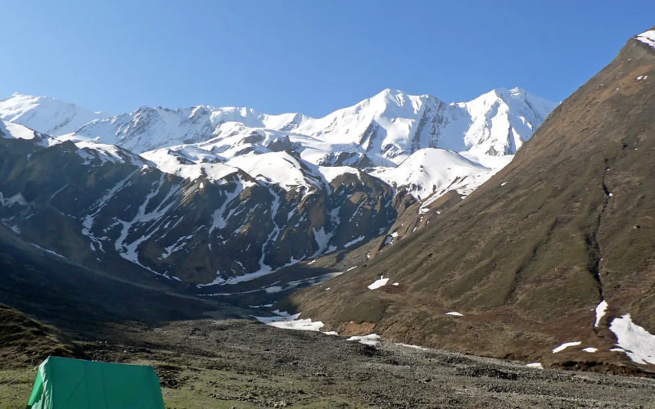
You will pass through Crystal Mountain School, a reputable high school along the way. The trail, as continued outside the school, leads to the base camp. The higher you go, the more rugged and remote the environment will be. Arriving at Numa La Base Camp (4,440 m / 14,567 ft), you will find a Buddhist monastery in the locality. Since there are no lodges or teahouses available here, the overnight stay is in tents. It is a critical place of stay prior to the high mountain pass on the next day.
Activity: 6 hours Trekking
Max. Altitude: 4,440m/14,567ft. (Numa La Base Camp)
Meal: Breakfast, Lunch and Dinner
Accommodation: Tent
This is one of the most hectic days of the trek since you are going to trek to Danigar through Numa La Pass. It starts with a gradual climb to the pass, through a rough path which slowly ascends into the mountains. The terrain and altitude demand patience and a steady pace in the climb.
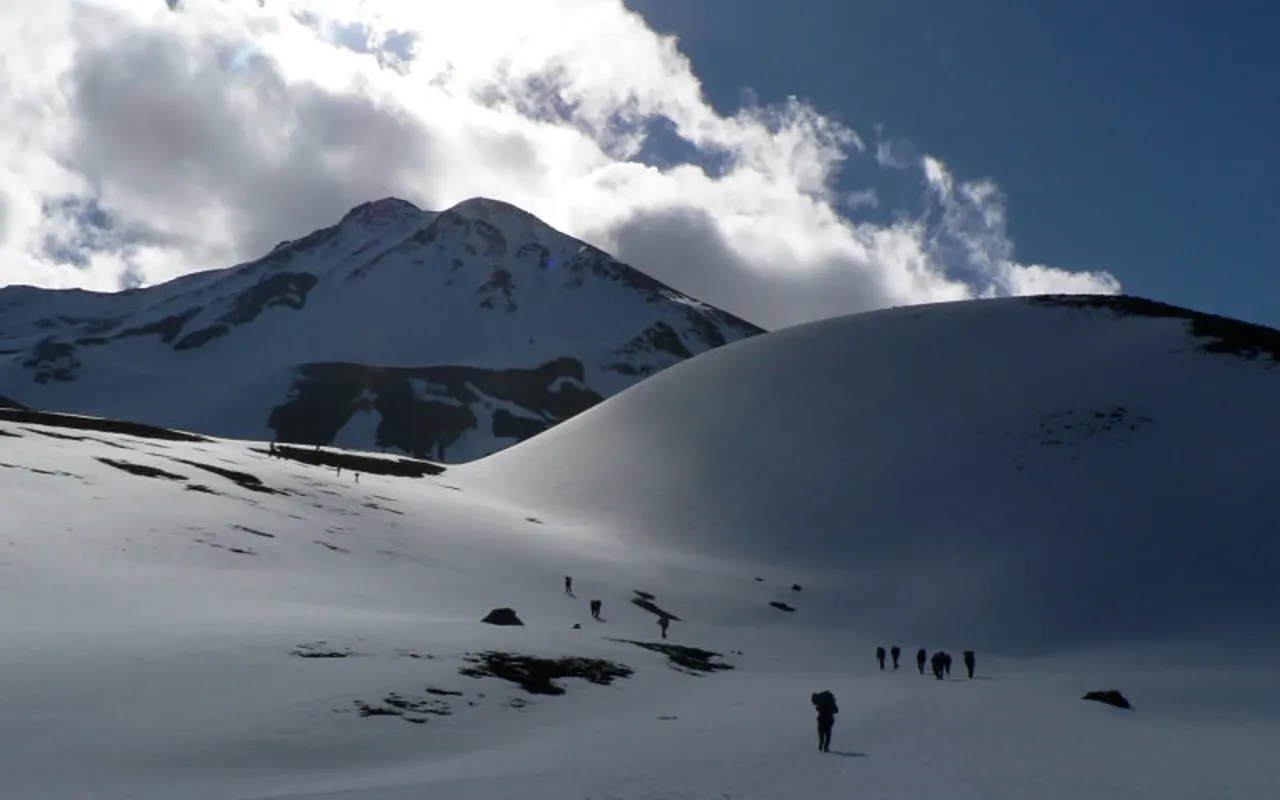
Numa La Pass (5,190 m / 17,028 ft) will be reached after several hours of uphill trekking. The pass provides panoramic views of the Himalayan landscape around it, such as mountain ranges and high valleys. The path takes a downward turn after some time at the summit to the lowlands. The downward part passes by Gyambo Khola to Danigar, which is characterized by open green fields. Since there are no teahouses here, the overnight stay will be in tents.
Activity: 7 hours Trekking
Max. Altitude: 5,190m/17,028ft. (Danigar)
Meal: Breakfast, Lunch and Dinner
Accommodation: Tent
Today you trek from Danigar to Yak Kharka by the Baga La Pass. This trail starts with a mountain pass ascent to a second high mountain pass. Due to the altitude, the climb is done at a gradual pace, which gives time to adapt to the thinner air as the progress is made safely.
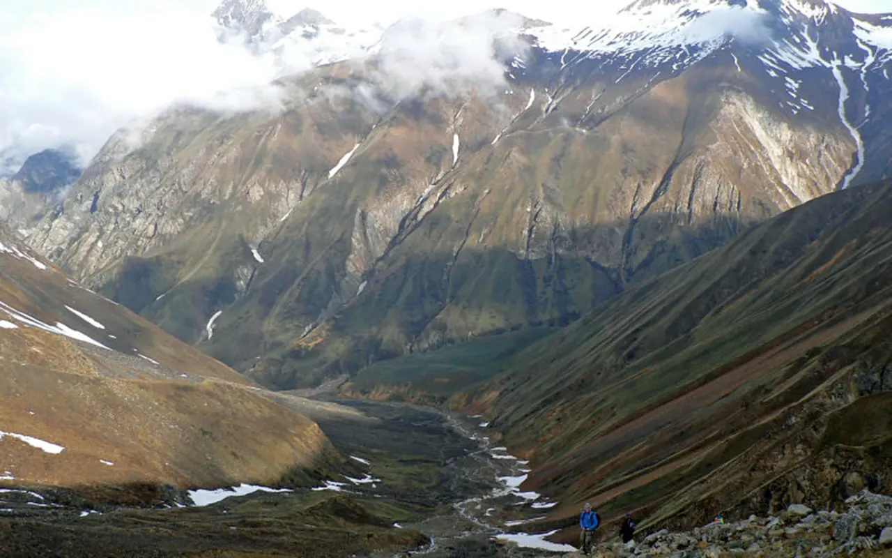
This significant spot on the route is also marked by prayer flags and chortens at Baga La Pass (5,214 m / 17,106 ft). It is a viewpoint where the mountains of Dolpo, Kanjirowa Himal, and Mount Norbung Kang can be viewed. When the weather is good, one can also see the Shey Phoksando Lake in the distance. Having seen the sights, the trail moves down to Yak Kharka, which is a grazing field where the yak herders graze seasonally. There are also a few accommodation facilities in this area, and the night is spent in bare-bones conditions as planning for the descent towards the lake region.
Activity: 6 hours Trekking
Max. Altitude: 5,214m/17,106ft. (Yak Kharka)
Meal: Breakfast, Lunch and Dinner
Accommodation: Lodge
Your journey will begin at Yak Kharka and go on to Phoksundo Lake. The route goes through forests that have pine, juniper, oak, and birch trees. As the trip continues, a perspective gives the initial glimpse of the renowned lake below, showing its characteristic blue and turquoise hues.
The path then turns down to the source of the Phoksundo Khola and goes on to Ringmo, a traditional Tibetan village. The lake is among the most significant natural objects in Nepal and has cultural values to the local communities. The landscape around it is quiet, and the Kanjirowa Himal located near the mountain contributes to the landscape. You can also visit Tshowa Gompa, an old Bon monastery at the top of the lake area and then finish the day at the lakeshore.
Activity: 4 hours
Max. Altitude: 3,733m/12,247ft. (Phoksundo Lake)
Meal: Breakfast, Lunch and Dinner
Accommodation: Lodge
The day is a rest day at Phoksundo Lake, and we can rest a little but do not get too active. Remaining at the height of (3,733 m / 12,247 ft), one can spend the day on the exploration of the surrounding environment and enjoying the cultural and natural landscape of this region.
You can also take time to visit Ringmo village, an ancient village that is characterized by Tibetan-style buildings, stone walls, and chortens. The people of the area are guided by pre-existing traditions that are still a significant aspect of their lives. An alternative is going to Tshowa Gompa, which is a ridge above the lake. The lakeshore is a nice place to take a brisk stroll in itself, as the colors in the water change with the day. The rest day also comes in handy to maintain equipment, restore energy, as well as to prepare for the last phases of the trek.
Activity: 3 hours Rest Day
Max. Altitude: 3,733m/12,247ft. (Phoksundo Lake)
Meal: Breakfast, Lunch and Dinner
Accommodation: Lodge
Today you will trek from Phoksundo Lake to Shyanta. The day will start with a walk up to a viewpoint above the village of Ringmo and will be the last chance to see the lake. The trail then leads down to Polam and Chunuwar, over winter-grazing country.
You will go through small settlements as you go on the route and then go down the river Suli Gad. The trail is still in the Shey Phoksundo National Park and loses its altitude slowly as the day goes by. On the way, one can see the local wildlife, which can be found within the protected area. In a few hours of walking, you will reach Shyanta, where you will be able to rest and spend a quieter evening after such a day of steady descent.
Activity: 5 hours Trekking
Max. Altitude: 3,733m/12,247ft. (Shyanta)
Meal: Breakfast, Lunch and Dinner
Accommodation: Lodge
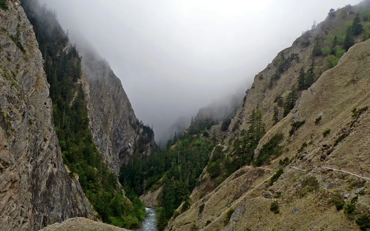
Today you start trekking from Shyanta to Juphal. The path travels along the river Suli Gad, and slowly leads back to lower valleys where there are more settlements and agriculture. At the beginning of the day, you will go through the check post of Sulighat where trekking permits are verified before you leave the national park area.
As you go farther along the path, the landscape is different, as you leave the higher valleys of Dolpo. Villages like Kageni and Kalagaonda give an insight into local agricultural activities and everyday life. The trail ascends up to Juphal as the trek continues, returning you to the same place where the trekking adventure was initially started. On arrival, you will be able to spend your last evening in the mountains. The end of the day is marked with a farewell dinner where one gets a chance to appreciate the guides and support staff who helped him/her during the trek.
Activity: 5 hours Trekking
Max. Altitude: 2,520m/8,268ft. (Juphal)
Meal: Breakfast, Lunch and Dinner
Accommodation: Lodge
The last day starts with a morning flight from Juphal to Nepalgunj. Flights on this route are usually booked early in the day due to the weather conditions and the few operations at the airports. Your final sight on the mountainous scenery that has been with you along Dolpo can be enjoyed during the flight.
Once in Nepalgunj, you will move to the domestic terminal and take up a flight to Kathmandu. The second flight is the one that takes you back to the capital city. When you land, the trekking adventure is over. It is now the moment to look back at the experiences that were acquired along the way, remote villages and mountain passes, and encounters with different cultures and nature. When you are ready to move on with your travel plans, you may proceed with packing up.
Activity: 2-hour flight
Max. Altitude: 1,400m/4,593ft. (Kathmandu)
Meal: Breakfast, Lunch and Dinner
Note:
If you have a private group and prefer a personalized experience, we can organize a custom trip tailored to your requirements and group size, running it any day you choose.
Transportation
Food and Accommodation
Guide and support staff
Permits and Expenses
Medical and Gear
Others
International Flights and Visa.
Food and Accommodations
Travel and Medical Insurance.
Other Expenses
The Lower Dolpo Trek can be undertaken at various times of the year, but the spring and autumn are generally regarded as the most favorable seasons. The spring months (March-May) are characterized by pleasant weather, sunny days, and flowering bushes in most areas of the trail. The period of autumn (September-November) offers good weather conditions, good mountain views, and comfortable trekking.
Lower Dolpo is a rain shadow region of the Himalayas and therefore does not get as much rain as most of the other trekking destinations of Nepal. One can also go on summer trekking, but certain sections may be influenced by weather conditions. The lower altitudes and mountain passes above (5,000 m / 16,404 ft) are colder than normal in winter. The selection of the season is part of the way to make the Lower Dolpo Trek more pleasant and comfortable.
Lower Dolpo Trek Nepal is rated as a difficult trekking path that can be attempted by well-fit trekkers who have prior experience in hiking. The route runs along isolated valleys, rocky terrain, and mountain passes. The amount of time spent walking is typically between five and seven hours on a daily basis; however, there are days when one has to work harder. The elevation of the trekkers has a point of more than 5,000 m / 16,404 ft), and the thin air can make walking more challenging.
Remote areas also contribute to the challenge due to basic facilities and poor infrastructure. While technical climbing skills are not required, good endurance and determination are important. The use of a Lower Dolpo Trek Itinerary, after a well-planned trip, assists the trekkers to adapt and complete the trip safely as they explore the culture and the beauty of the region.
Another factor to keep in mind during the Lower Dolpo Trek is altitude sickness, as the trail elevation is high, with a pass being even higher in altitude above 5,000 m / 16,404 ft. Oxygen in the air goes down with the increase of altitude, making it more difficult for the body to adjust. Symptoms such as headache, dizziness, fatigue, nausea and insomnia are common. The risk should be reduced by proper acclimatization.
The body can be adjusted by drinking lots of water, running at an even pace and not overworking. The itineraries have acclimatization days in major places to facilitate safe trekking. In case of severe symptoms, it is better to go down to a lower elevation. The Lower Dolpo Trek Nepal can be made safer and enjoyable with careful planning and awareness.
Good preparation is important for a successful Lower Dolpo Trek. As the trek will entail long walking days and mountain passes, the trekkers are advised to start body training a few weeks prior to the trip. Endurance and stamina can be enhanced by regular hiking, walking, jogging, cycling and climbing stairs. The trek can also be made more comfortable by strengthening the legs and core muscles. Mental training is also essential since the path is through isolated regions with few amenities.
It can be practiced by making multi-day hikes with a light pack on the back to develop confidence. A comprehensive Lower Dolpo Trek Itinerary enables trekkers to be aware of obstacles they will face in their daily lives and be prepared. When they are properly prepared and fit, the trekkers can appreciate the nature, culture, and the various experiences that they encounter during the trip.
The food and accommodation in the Lower Dolpo Trek will be different according to the place. Simple teahouses are common in lower villages where trekkers can have simple meals and rest areas. Foods that are common are rice, noodles, soups, potatoes, vegetables, bread, and hot drinks. In more remote regions as the route is followed, accommodation becomes simpler, and it may be necessary to camp in some places. Rooms are typically basic yet offer a place to sleep and rest after a day of trekking.
Food options can be reduced in altitude and remote camps. Nevertheless, the rudimentary facilities do not hinder good hospitality locally. The experience gives trekkers an opportunity to experience the local culture as well as the serene environment of remote mountain communities.
The Dolpo Trek of Nepal is a significant transportation aspect since the area is one of the most remote in Nepal. The trek usually starts with a Kathmandu to Nepalgunj flight, and then a Nepalgunj to Juphal flight, which is the starting point of the trekking route. The domestic flights are useful in minimizing the travel time and also providing access to areas that would otherwise take several days of overland travel.
The majority of trekking itineraries cover all the airport transfers and transport arrangements. The weather sometimes interferes with flight schedules, particularly in mountainous areas. Trekkers ought to be flexible in their plans. Transport planning: Proper transport planning provides a smoother travel experience and makes trekkers start their adventure without any needless delays.
The communication facilities on the Lower Dolpo Trek are poor since the trail cuts across the mountain valleys and remote villages. At lower places, mobile network coverage is good, but the signal can be weak or non-existent at higher elevations and remote camping spots. In most parts of the trek, there is limited or no access to the internet. Before they set off, trekkers are expected to notify family members and friends about potential communication gaps.
When necessary, guides usually carry communication equipment in case of emergency. Some villages may have limited power supply, and a power bank or power supply in the form of additional batteries can come in handy. Embracing moments of being offline will enable the trekkers to pay more attention to the land, culture, and other exclusive features of the journey.
Lower Dolpo Trek needs special permits due to the region being a restricted zone. Before beginning the trek, Trekkers need to acquire a Lower Dolpo Restricted Area Permit and a Shey Phoksundo National Park Entry Permit. With the assistance of these permits, tourism is controlled, and conservation activities are promoted in the area. The trek is not allowed in restricted zones, and therefore the trekkers are normally required to be accompanied by a registered guide and a registered trekking agency.
The price of permits can vary, and it is better to check the existing regulations before making a reservation. In most of the trekking packages, the permit is included in most organized trekking packages on behalf of the trekkers. It is necessary to bring permit documents with you during the trip because they are inspected at different control points during the trip.
The Lower Dolpo Trek requires a tourist visa for all international travelers coming to Nepal to explore the trekking destination. Nepal provides visa-on-arrival to citizens of most countries at Tribhuvan International Airport in Kathmandu and some of the crossings of land borders. Travelers are advised to make sure that their passport is valid at least six months ahead of the intended time of travel. The visa charges differ according to the duration of stay chosen.
Visa regulations are subject to change, so it is always advisable to ensure you are updated on the latest visa requirements before traveling. Given that the Lower Dolpo Trek Itinerary normally extends over a period of over two weeks, trekkers would be required to select a visa period that includes the number of days they will be in Nepal, including the arrival and departure days.
Anyone intending to do the Lower Dolpo Trek is highly advised to have travel insurance. The path leads to isolated mountainous locations and elevations with (5,000 m / 16,404 ft) where emergency aid may be more difficult to coordinate. Appropriate insurance cover must include high-altitude trekking, medical care, emergency evacuation, trip interruptions and travel delays.
Helicopter evacuation can be expensive in remote parts of Nepal making insurance important. Trekkers ought to read through the coverage provisions and altitude restrictions before making a purchase. It is also advisable to carry a copy of insurance information during the trek. Good insurance offers comfort and assists to cover the unforeseen costs when traveling.
Although most trekking packages cover major services, trekkers are expected to spend extra money of their own when undertaking the Lower Dolpo Trek Nepal. Other expenses can be snacks, soft drinks, bottled water, hot showers, battery charge, Internet, laundry, and personal shopping. Guides, porters, and support staff tips are also common and must be planned separately. Package prices may not necessarily include travel insurance, visa charges, and personal trekking gear.
Flight delays and related emergency costs and additional accommodation can also add to costs. It is essential to carry sufficient amounts of cash since there are no banking facilities and ATM machines in most trekking locations. Adequate budgeting ensures that the trekkers have the time to enjoy their trek without having to fear any kind of surprises along the way.
Lower Dolpo Trek may be either a private or group trek based on personal interests and objectives of travel. A private trek is more flexible, which means that the trekkers can schedule, pace, and services to meet their needs. Group treks can also prove to be cheaper since expenses are shared among the trekkers. They also offer the chance to have other people and share the travel experiences.
Both packages entail skilled guides, authorization, and logistics. Companies like 3A Adventure will be able to plan individual and group departures depending on the needs of the travelers. The decision to go on a private or group trek is based on the budget, the flexibility required, and the general trekking experience that each traveler would choose.
General
The trek normally lasts between 15 and 20 days, depending on the itinerary adopted.
The trek is in Dolpo Valley in the isolated western Nepal.
It is a difficult trek that usually requires trekkers who are in good condition and have experience with some hiking.
Preparation & Fitness
It is advised to be physically fit because the day of walking is long and the terrain is high.
Your body can be prepared by regularly hiking, walking, jogging, cycling and climbing stairs.
Insurance & Visa
Yes, in-depth travel insurance including high altitude trekking is strongly suggested.
The majority of foreign tourists need to have a tourist visa to access Nepal.
Guides & Support Staff
Yes, it is usually necessary to hire a licensed guide since Lower Dolpo is a trekking zone.
Yes, porters may be ordered to carry your main baggage and lessen the amount you carry.
Accommodation and Facilities
Basic teahouses and camping in remote parts of the route can be arranged.
In remote areas, the charging facilities might be few and electricity is available in certain villages.
Weather & Seasons
The best seasons to trek in the area are usually the spring and autumn seasons.
Yes, some areas of Lower Dolpo do not get as much rainfall due to the fact that the area is in a rain shadow.
Health & Safety
The climb goes up to altitudes above (5,000 m / 16,404 ft) and appropriate acclimatization is essential.
Booking & Payment
It is advisable to book a few weeks/ months beforehand, and particularly during high seasons of trekking.
Transportation & Flight
The majority of the Lower Dolpo Trek Itinerary plans start with flights from Kathmandu to Nepalgunj and further to Juphal.