
Need Help?
+977 9860666075

Based on 27 reviews
Trip Duration
15 DaysTrip Difficulty
ModerateMax Altitude:
5,416m. / 17,769ft.Group Size
2-20 PeopleBest Season
Oct-Dec & Mar-MayMeals
Breakfast, Lunch & DinnerAccommodation
Hotel, TeahouseTransportation
Flight, BusAnnapurna Circuit Trek with Tilicho Lake is an enjoyable adventure through some of the most varied mountainous terrain in Nepal. The trip is a blend of the standard Annapurna Circuit trail and exploration of Tilicho Lake and is a journey that provides not only natural scenery but also cultural exploration. Trekking through villages, along rivers, forests, up the mountains, and across high mountain passes, the trekkers have sights of the Annapurna range and the other mountains around.
The trip starts with a Kathmandu to Jagat drive and then walking into the Annapurna region. The scenery is transformed as the trail gradually ascends in altitude, with the landscapes becoming mountainous and rocky. The Trekkers go through the villages like Dharapani, Chame, Upper Pisang, Ngawal, and Manang, where the culture and the traditions of the mountains are still a significant part of life.
One of the most important attractions of the Tilicho Lake Trek Nepal is the visit to Tilicho Lake (4,920 m / 16,142 ft). The lake is surrounded by high mountains and thus provides a serene environment and spectacular views. Accessing the lake takes a beautiful side journey off the main Annapurna Circuit trail, which enables trekkers to have the opportunity to visit one of the most picturesque high-altitude locations in the area.
The other significant aspect of the adventure is that Thorong La Pass (5,416 m / 17,769 ft) is crossed. This marks the summit of the hike and one of the greatest milestones of most trekkers. The pass views span over the Himalayan scenery and the downward pathway is to the holy pilgrimage center of the Hindus and Buddhists, Muktinath.
The Annapurna Circuit Tilicho Lake Trek can be recommended to those trekkers who want to have a mixture of mountainous landscape, culture and self-realization. The itinerary includes proper acclimatization, which assists trekkers to safely adapt to higher levels. The path also offers chances to enjoy the distinct way of life of the people in remote villages in the Himalayas.
In the fertile valleys of the Marsyangdi River, as well as in the dry terrains of Mustang, something different is revealed daily. The trek ends at Jomsom and then takes a scenic flight to Pokhara and the flight back to Kathmandu. In the company of seasoned climbers, well-crafted logistics, and personalized attention to the journey, 3A Adventure will enable the trekkers to experience a secure and unforgettable experience in the Annapurna region.
Your trip starts early in the morning out of Kathmandu and towards Besisahar. The road passes up and down winding through river valleys, small towns and cultivated farmlands. During the trip, you may see everyday life in the country and have a sight of green hills and running rivers. The route to Besisahar is mostly well-maintained and it will take some hours to get there.
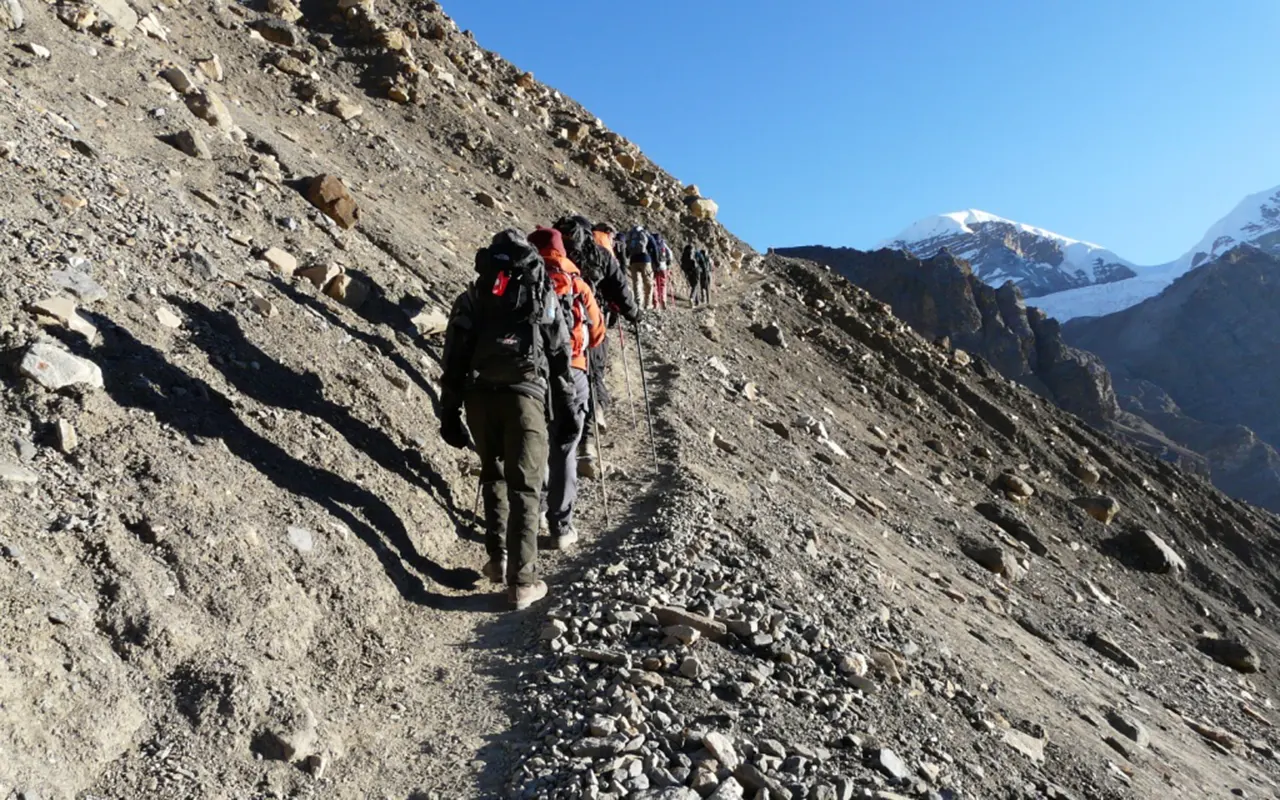
Once you get to Besisahar, you go further into the mountains using the local jeep. The trail is along the Marsyangdi River and through dense forests, terraced lands and the more traditional villages. The landscape grows wilder and more distant, as the path ascends slowly. You proceed through a few settlements and agricultural land before coming to the small village of Jagat (1,300 m / 4,265 ft). This village is the base of your trekking adventure in the Annapurna Region.
Activity: 8 hours drive
Max. Altitude: 1,300m/4,265ft. (Kathmandu )
Meal: Breakfast, Lunch and Dinner
Accommodation: Teahouse
After breakfast, you start your journey from Jagat to Dharapani. The trail is across beautiful scenery that consists of waterfalls, rocky cliffs and river valleys. The landscape slowly becomes different as you rise higher up, giving you greater panoramic views of the hilly landscape and the village around you.
The pathway goes to a lovely village of Tal in the Manang area. Close to waterfalls, a stream flows into streams which ultimately merge with the river below. Still moving on, you pass through farmlands where local farmers cultivate potatoes, rice and barley. The trail leads to Kodo, one of the larger of the settlements in the valley.
Passing through a suspension bridge and through a classical stone Kani, a last gradual climb leads to Dharapani. Dharapani (1,860 m / 6,102 ft) is a tourist resthouse and a strategic entry point to the upper sections of the Annapurna Circuit.
Activity: 6 hours trek
Max. Altitude: 1,860m/6,102ft. (Dharapani)
Meal: Breakfast, Lunch and Dinner
Accommodation: Teahouse
It is a more strenuous trekking day today since you are leaving Dharapani and heading to Chame. The trail ascends continually through woods and the river valley during much of the day. The path will be quite long and will have a lot of elevation.
As you proceed with the walk, it starts to show great sights of Lamjung Himal, Annapurna II and IV. The trees around it are a source of shade and also variety to the landscape. Several rivers run through, and you have to cross them on suspension bridges with colorful prayer flags.
Even though some of the bridges might not be easy to navigate initially, it would be easy to quickly turn into a fun experience during the trekking journey. The last part is an upward progression towards Chame, the capital of the Manang District. Chame (2,670 m / 8,760 ft) has spectacular mountainous views in all directions.
Activity: 6 hours trek
Max. Altitude: 2,670m/8,760ft. (Chame)
Meal: Breakfast, Lunch and Dinner
Accommodation: Teahouse
You leave Chame after breakfast and pass through a small valley with mountain scenery. One of the first things to see on the trek is the huge Paungda Danda Rock, a huge curved rock face and 1,500 meters above the Marsyangdi River. This is a natural landmark that is of high cultural significance to local communities.
The path then moves through pinewood and open areas which give pretty views of the neighboring mountains. Pisang Peak is visible to the northeast of the route and Annapurna II is visible in the south skyline. The landscape is getting more and more dramatic as one gets further into the valley.
Slowly descending leads you to finally reach the Pisang region. Here you proceed to Upper Pisang (3,300 m / 10,827 ft). It has good sightseeing of the Annapurna range and is a good village to stay in prior to heading to higher settlements of Manang.
Activity: 5 hours trek
Max. Altitude: 3,300m/10,827ft. (Upper Pisang)
Meal: Breakfast, Lunch and Dinner
Accommodation: Teahouse
Today you trek from Upper Pisang to Gyaru and Ngawal. The walk starts along a delightful path, which has a little green lake and affords extensive glances down the valley. The beautiful landscapes and traditional mountain settlements characterize this area.
You cross a suspension bridge and then a mani wall, after which you begin a steep ascent towards Gyaru. The path is taken up the mountain in a zigzag fashion, which offers good scenery as you go upwards. The more you hike up the mountain, the greater the mountain landscapes around you will be breathtaking.
And leaving Gyaru, the path runs on to Ngawal. The trail has a small hillocky stretch before it slowly winds down into the village. Ngawal (3,660 m / 12,008 ft) has great views of the Annapurna region.
Activity: 4 hours trek
Max. Altitude: 3,660m/12,008ft. (Ngawal)
Meal: Breakfast, Lunch and Dinner
Accommodation: Teahouse
Today you trek from Ngawal to Manang. There are strange rock formations in the wind, pine trees scattered along the way and open mountain country. This is an enjoyable and fairly short trekking day in the changing terrain.
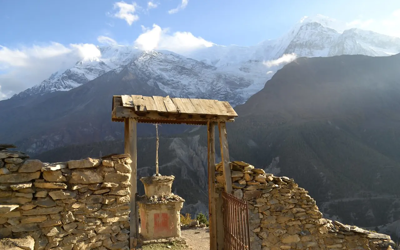
Beautiful scenery of the Annapurna massif follows you all the way through the journey. The path then traverses the beautiful village of Bhraka with its old-fashioned houses and serene environment. This part is a good chance to experience the peculiar culture and landscape of the area.
A brief stroll past Bhraka will lead you to Manang (3,540 m / 11,615 ft). Located on the Annapurna Circuit, Manang is a large community with stunning mountain scenery, cozy tea houses and trekker services to the higher altitudes.
Activity: 3-hour trek
Max. Altitude: 3,540m/11,614ft. (Manang)
Meal: Breakfast, Lunch and Dinner
Accommodation: Teahouse
Today is spent acclimatizing at Manang. It is essential to take time to adapt to the rising altitude before proceeding to higher altitudes. Instead of sitting, you will go out on a short walk to allow your body to get used to it as you savor the scenery.
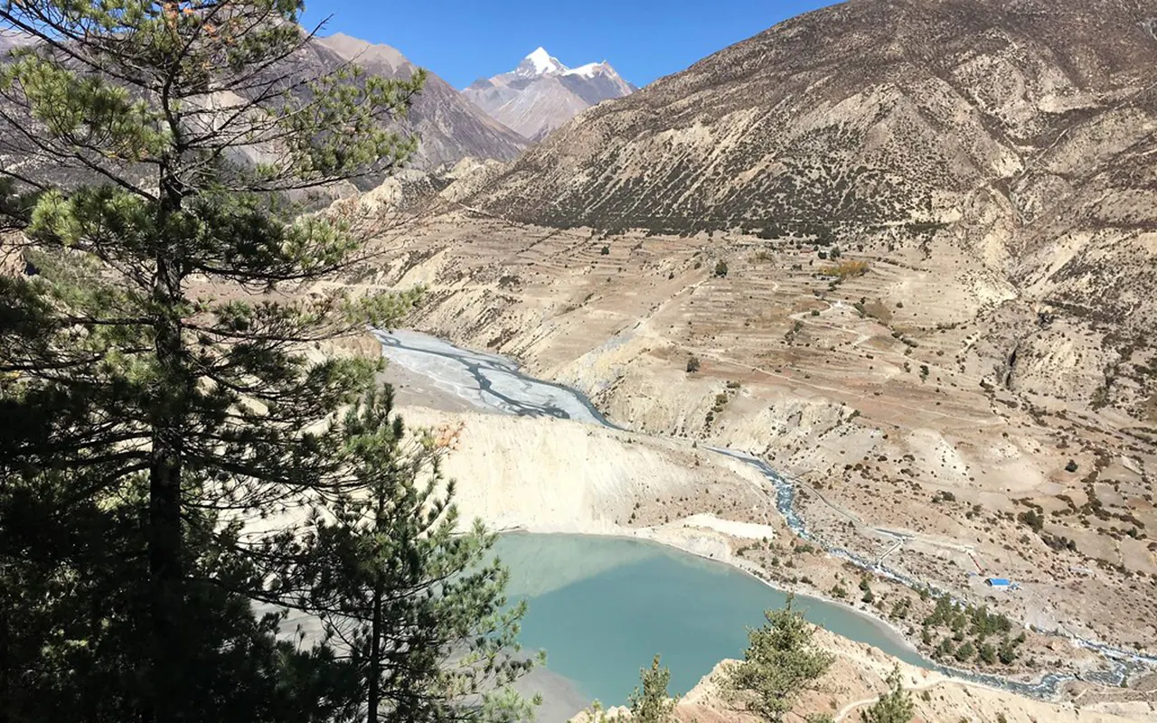
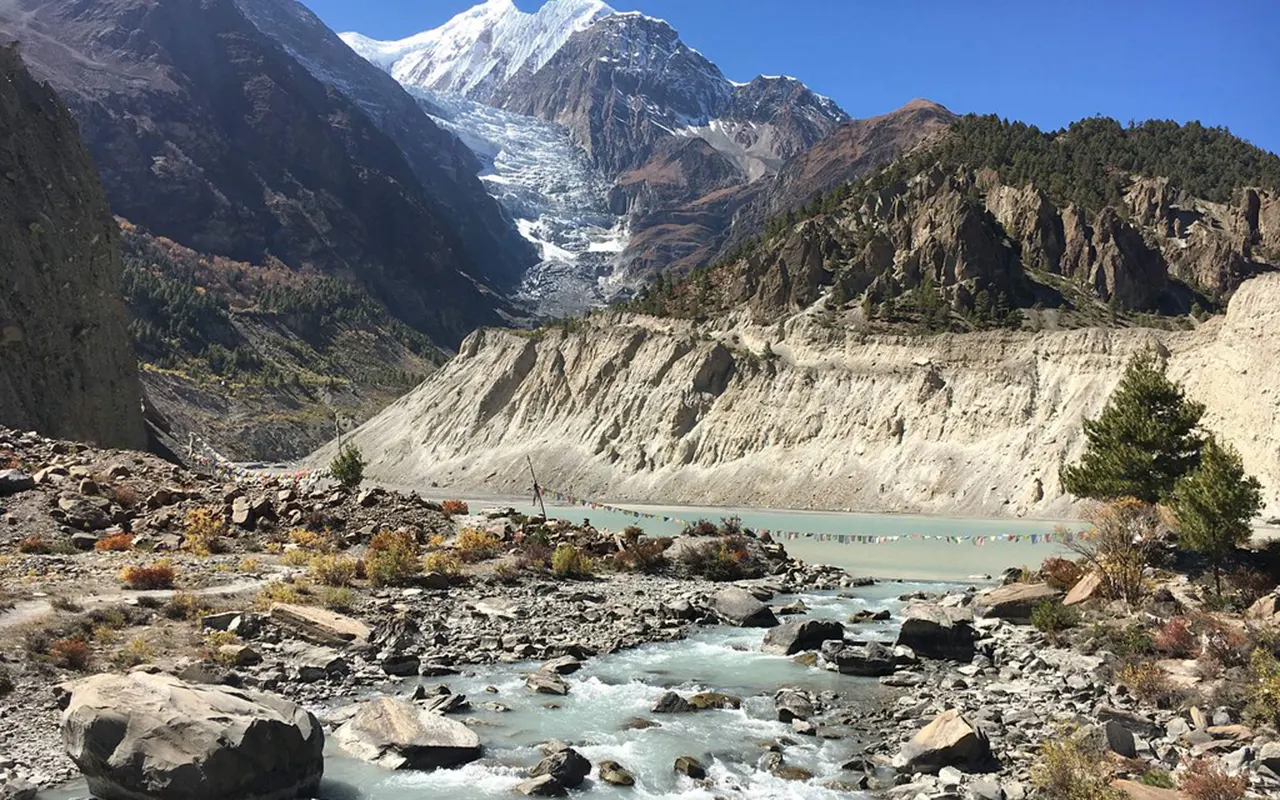
An acclimatization stroll takes you to the Gangapurna viewpoint. Here, you will have a great view of the Gangapurna Glacier, Gangapurna Lake, Annapurna peaks, Pisang Peak and the mountainous landscapes. The elevation attained during the hike is also beneficial in assisting the acclimatization.
In Manang, you can spend the rest of the day resting, sightseeing in the village or at the Gangapurna Lake, after re-entering Manang. This is a significant day to have a safe and pleasant trek ahead because of the light activity and rest mixed.
Activity: 3 to 4 hours hike
Max. Altitude: 3,900m/12,795ft. (Manang)
Meal: Breakfast, Lunch and Dinner
Accommodation: Teahouse
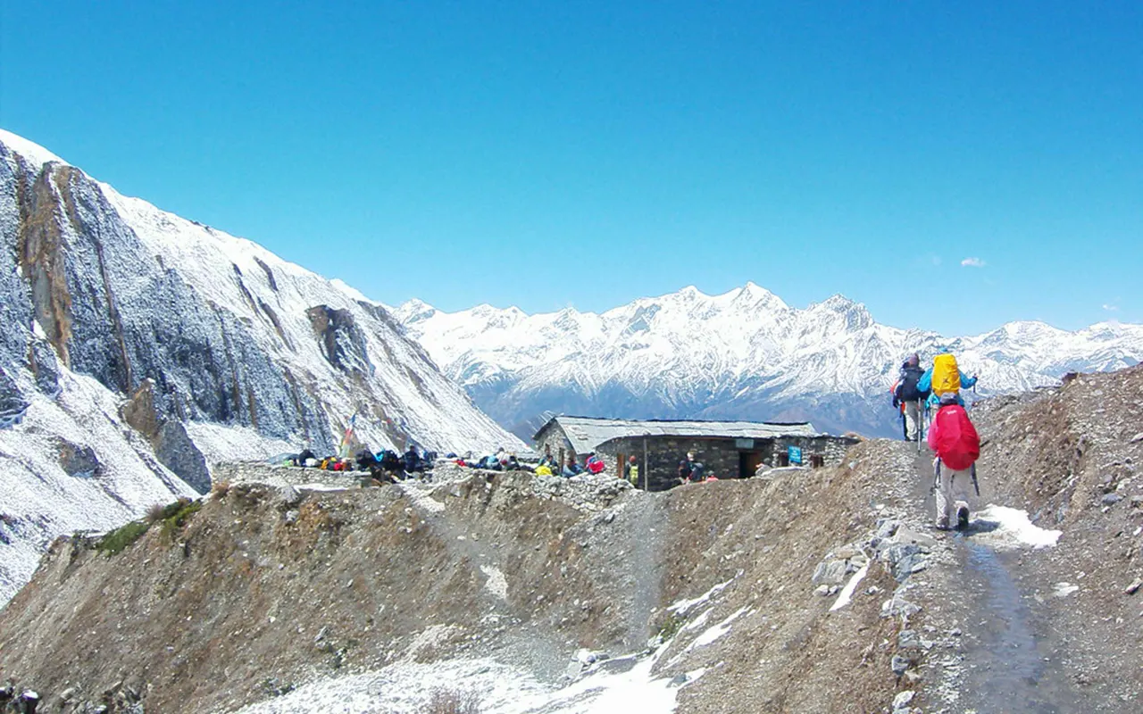
You will trek from Manag to Shree kharka and Tilicho Base Camp. The trail cuts through mountainous terrain and offers spectacular scenery of snow-clad mountains in the daytime. The journey is surrounded by spectacular scenery such as Annapurna, Nilgiri and other surrounding mountains.
Shree Kharka is reached after a few hours of walking. A frequent resting place of trekkers on their way to Tilicho Lake is this tiny settlement. Here you may have lunch and take a rest before going on to higher up the mountains.
It then proceeds on a rough path to Tilicho Base Camp. The higher you are, the more alpine and isolated the environment is. Towards the end of the afternoon, you arrive at Tilicho Base Camp (4 150 m / 13 616 ft), where you will be preparing to hike early the next morning to Tilicho Lake.
Activity: 7 hours trek
Max. Altitude: 4,150m/13,615ft. (Tilicho Base Camp)
Meal: Breakfast, Lunch and Dinner
Accommodation: Teahouse
Today starts before sunrise when you move out of Tilicho Base Camp and head towards Tilicho Lake. The trail slowly ascends through a rough alpine terrain with a spectacular mountain geography everywhere. When the sun comes up, it is clearer to see the surrounding peaks, and this makes the day start memorable.
You arrive at Tilicho Lake (4,920 m / 16,142 ft) after many hours of walking. The lake is encircled by the high mountains and is characterized by a peaceful atmosphere and natural beauty. You will get time to appreciate the landscape and capture photos before starting the descent.
The path then continues in the same path back to Tilicho Base Camp to have lunch. You then proceed trekking down to Shree Kharka, where you will spend the night. Though it is a long day, the chance to visit the Tilicho Lake would make the effort worth it.
Activity: 9 hours trek
Max. Altitude: 4,920m/16,142ft. (Tilicho Lake)
Meal: Breakfast, Lunch and Dinner
Accommodation: Teahouse
You leave Shree Kharka after breakfast and head towards Yak Kharka. The path goes past empty hills, alpine meadows and places where local animals graze in the warmer seasons. As you ascend higher up the mountains, the landscape grows more barren.
You can also observe numerous alpine plants on the way and there will be no breaks in the view of the surrounding mountains. The trail is normal and you can take time to enjoy the shifting scenery.
On arriving at Yak Kharka, you go on along the valley to Ledar. This part is along a ridge line which offers great scenery on either side of the valley. It is late afternoon when you reach Ledar at an elevation of (4,200 m / 13,780 ft), where you will camp.
Activity: 5 hours trek
Max. Altitude: 4,200m/13,780ft. (Ledar)
Meal: Breakfast, Lunch and Dinner
Accommodation: Teahouse
Today you will leave Ledar and head to Thorung Phedi. The path is slowly climbing over a wilder terrain that contains fewer trees and is rather rocky. The scenery around is a hint of the hard but beautiful environment of the high Himalayas.
As you progress along the valley, you might see wildlife adapted to these elevations. The trail is stable and offers great scenery of the mountains and rocky hills around it. Several hours of hiking lead you to Thorung Phedi, which is a significant landmark before Thorong La Pass.
After a brief rest, you proceed to climb to High Camp. High Camp (4,925 m / 16,159 ft) puts you in a more favorable position for the difficult pass on the next day.
Activity: 4 hours trek
Max. Altitude: 4,925m/16,158ft. (High Camp)
Meal: Breakfast, Lunch and Dinner
Accommodation: Teahouse
This is one of the most critical and crucial days of the trek. It starts early in the morning, and up the Thorong La Pass you climb steadily. The trail is guided by an established pathway, which has linked communities in Manang and Mustang over centuries.
The higher you climb, the more spectacular are the views. Reaching Thorong La Pass (5,416 m / 17,769 ft), you are rewarded with panoramic views of the Himalayan range. To your north you will see the direction of Tibet, and to the south, the Annapurna mountains are taking charge of the horizon.
You at last start down the long path to Muktinath after a short stay at the pass. The path becomes progressively less steep and crosses open hills and grassy fields. Later in the afternoon, you arrive at the religious pilgrimage location of Muktinath (3,760 m / 12,336 ft), a holy place of Hindus and Buddhists, where temples and monasteries are found.
Activity: 8 hours trek
Max. Altitude: 5,416m/17,769ft. (Thorong La Pass)
Meal: Breakfast, Lunch and Dinner
Accommodation: Teahouse
You start a lengthy downward journey after breakfast at Muktinath to Jomsom. The path crosses the Kali Gandaki Valley and it traverses desert-like areas as is typical of Mustang. The route is more downhill walking and gradual compared to the past days.
On the way, you arrive at the historic village of Kagbeni. This historic town has narrow streets, ancient houses and a great monastery. The village is located at the entrance to Upper Mustang and it is a cultural hub. You will be able to enjoy the area and see its unique architecture.
The trail goes on, leaving Kagbeni and heading towards Jomsom along the valley floor. Powerful mountain scenery can be seen during the walk. In the late afternoon, you come to Jomsom (2,720 m / 8,924 ft), and it will be your last night in the mountains.
Activity: 6 hours trek
Max. Altitude: 3,760m/12,336ft. (Muktinath)
Meal: Breakfast, Lunch and Dinner
Accommodation: Teahouse
This morning, you board a plane to Jomsom Airport where you make a scenic flight to Pokhara. The flight is a short one with breathtaking air trips through the Himalayan mountains, deep valleys and mountain villages. It comes as a refreshing break after a couple of days of walking the Annapurna region.
Once in Pokhara, you will be welcomed and will be transferred to the hotel of your choice. Our rep will help with carrying your luggage and checking into the hotel and will then take you to your room. The rest of the day is at your leisure to rest and relax.
Pokhara has restaurants, shops and good walking tracks which provide a good environment. Having been in distant mountain areas, most trekkers find the time to relax and take time to look back at their journey.
Activity: 20-minute flight
Max. Altitude: 2,720m/8,924ft. (Jomsom)
Meal: Breakfast, Lunch and Dinner
Accommodation: Hotel
You leave Pokhara after breakfast and start the journey back to Kathmandu by tourist bus. The route is along picturesque highways, up and down along river valleys, through agricultural areas and small villages. During the trip, you will be able to see the surrounding countryside and the local life along the way.
During the major portion of the trip, the highway is along the Marsyangdi River, which later merges with the Trishuli River. The changing scenery provides an enjoyable conclusion to your adventure. There will be chances to have refreshments and brief breaks in between.
Towards the end of the afternoon or early evening, you come back to Kathmandu and this completes your trip to Annapurna Circuit and Tilicho Lake. You can also have the option of taking a short domestic flight in Pokhara, instead of using the road.
Activity: 8 hours drive
Max. Altitude: 822m/2,697ft. (Pokhara)
Meal: Breakfast, Lunch and Dinner
Note:
If you have a private group and prefer a personalized experience, we can organize a custom trip tailored to your requirements and group size, running it any day you choose.
Transportation
Food and Accommodation
Guide and Support Staff
Permits and Expenses
Medical and Gear
Others
International Flights and Visa
Food and Accommodation
Travel and Medical Insurance
Other Expenses
The weather in the Annapurna Circuit Trek with Tilicho Lake varies considerably with a shift in location between the low valleys and mountain passes. In general, temperatures are warmer in lower regions and much colder in higher altitudes. The weather is unpredictable around Thorong La Pass and Tilicho Lake and thus trekkers must be ready to face the sun and cold.
March to May is a very popular time of the year to do this trek. The weather is pleasant with comfortable temperatures, trails are well-maintained and mountain views are generally clear. There are numerous hillsides with rhododendron forests in blossom, which make the landscape more colorful.
The other good season of the Tilicho Lake Trek Nepal is autumn (September to November). It is perfect for trekking due to stable weather, clear skies and clear visibility. Winter is colder, whereas the summer monsoon usually causes rains and low visibility in the lower part of the route.
The Annapurna Circuit Trek with Tilicho Lake is regarded as a moderately/challenging trek. It contains several days of long hikes, constant upsloping and high altitudes. Trekkers must also be ready to hike daily, which may take between five and nine hours based on the itinerary.
The increase in altitude during the trip is one of the key challenges. The trek reaches Tilicho Lake (4,920 m / 16,142 ft) and crosses Thorong La Pass (5,416 m / 17,769 ft). Exercising at such high altitudes demands additional strain due to the thin air and the evolving weather conditions.
Experience in trekking may be useful, although it is not compulsory. Most of the trekkers are able to pass the route with adequate preparation, a reasonable fitness level and time to pass through the acclimatization. It might be safer and more enjoyable to follow at your own speed and heed the guidance of your guide.
The Annapurna Circuit Trek with Tilicho Lake is a significant factor that must be considered due to the altitude (5,000 m / 16,404 ft). The altitude also reduces the supply of oxygen available and this can occur to some trekkers irrespective of their age or fitness level.
The usual symptoms are headaches, lack of appetite, dizziness, nausea, and sleeping difficulties. These are symptoms that cannot be overlooked. The itinerary consists of an acclimatization day in Manang (3,540 m / 11,615 ft) to allow trekkers to get used to higher altitudes steadily.
The risk of altitude-related problems can be mitigated by proper hydration, regular walking and avoiding unwarranted exertion. When symptoms become severe, it is usually safe to go down to a lower altitude. The Annapurna Circuit Tilicho Lake Trek has professional guides who take special care of the trekkers and assist them whenever there is a need to make sure that the trek is safe.
Preparation can be of great help in the Annapurna Circuit Trek with Tilicho Lake. As the trail involves long trekking days and elevated altitudes, it is advisable to start the preparation a few weeks before arriving in Nepal. Stamina and endurance can be enhanced by regular walking, hiking, and cardiovascular exercises.
The reinforcement of legs and core muscles can also be used in uphill and downhill portions. Stair climbing, cycling, jogging or day hikes are some of the activities that can be used to prepare. Gradual training over time is usually more effective than having a hard training period just before the trek.
Mental preparation is also very crucial. There are days when the time spent on the trail is very long, and the weather can vary. When the trekkers have a positive attitude and realistic expectations, the experience can be more pleasant. 3A Adventure suggests that you should come with a reasonable fitness level in order to fully enjoy the trekking adventure as well as the mountain view.
The Tilicho Lake Trek Nepal is a trek that has food and accommodation offered by local teahouses and lodges along the way. These are setups that provide basic yet comfortable amenities to trekkers who pass through the Annapurna region.
Food usually consists of rice, noodles, soup, potatoes, vegetables, eggs, bread and typical Nepali foods. Additional menu options can be offered in bigger villages. Many of the stops along the trail also sell hot drinks, snacks and desserts.
The accommodation is usually in twin-sharing rooms with simple beds and blankets. The higher the altitude, the more difficult it is to reach the facilities, especially around the Tilicho Base Camp and High Camp. The majority of lodges have restaurants where trekkers can rest and socialize after a day of walking. Although there are few luxury facilities, the hospitality of the local hosts contributes to a homely trekking experience.
Transportation for the Annapurna Circuit Tilicho Lake Trek typically starts with a drive through Kathmandu to Jagat through Besisahar. The trip involves travel in river valleys, crop farms and mountainous terrain up until the beginning point of the walk.
Once the trek is over at Jomsom, trekkers usually fly to Pokhara. This is a short flight that provides spectacular views of the mountains, and it greatly saves time as opposed to land transport. It is then possible to go back to Kathmandu by a tourist bus or a domestic flight.
The transportation can be organized by 3A Adventure based on the chosen itinerary and travelling preferences. There might also be an option of private cars, which will be more comfortable and flexible. Transportation coordination is one of the ways to make sure that the trek will be a more comfortable experience.
Most of the villages on the Annapurna Circuit Trek with Tilicho Lake have communication facilities, but the quality of service differs depending on the location and the weather. Bigger settlements tend to be more accessible to communication services than high-altitude and remote settlements.
Most parts of the route have access to mobile phone coverage by the local network service providers. The signals can be weak or non-existent in the areas that are farther away, like the Tilicho Base Camp and High Camp. Many teahouses provide WiFi services, typically at a fee.
The family and friends should be informed that sometimes there might be limited communication during the trek. Having a phone with a full charge and a power bank can be handy. Although most of the journey can be done by keeping in touch, there are times when the remote nature of the mountains will result in some disconnection.
The Tilicho Lake Trek Nepal needs several permits. Such permits aid in controlling the trekking activities and contribute to the conservation in the area. Trekkers are required to bring the required documents along to the trekking region.
Annapurna Conservation Area Permit (ACAP) is necessary since the route is located within the reserved zones used in the conservation of the environment. A TIMS card is also required by trekkers in case it is needed according to the existing trekking rules at the time of travel.
Sometimes the permit requirements may be altered and thus before departure, one should ensure that the current regulations are checked. In case of booking with 3A Adventure, our team can help to receive the needed permits and organize all the documents to be ready and right before the trek starts.
Trekking the Annapurna Circuit Tilicho Lake, international travelers usually need to obtain a tourist visa to Nepal before entering the country. Nepal provides easy visa policies to most nationalities, and therefore the entry process is relatively easy.
Before traveling, tourist visas may frequently be acquired, either at Kathmandu International Airport or at a Nepalese embassy or a Nepalese consulate. The required validity is dependent on your intended stay in Nepal.
Visitors are expected to make sure that their passport is not less than half a year from the date of entry. It can also be handy to carry passport-sized photographs and the required visa fees to make the application process easier. Immigration laws can be modified, so it is always best to ensure that one knows the current requirements before traveling.
Travel insurance is highly advisable for anyone who has to take part in the Annapurna Circuit Trek with Tilicho Lake. Hiking in the isolated mountain areas is characterized by some risks such as altitude diseases, weather problems, and unforeseen health conditions.
An insurance policy must cover emergency medical care, helicopter evacuation, trip interruption and trekking coverage above 5,000 m / 16,404 ft. High altitude is not covered automatically in all insurance policies, and it is important to note the details.
Insurance gives tranquility to both the trekkers and their family. Proper coverage in case of an emergency will reduce the financial burden and help obtain the required help quickly. An excellent aspect of trip preparation is to buy comprehensive travel insurance prior to arriving in Nepal.
Despite all the services provided in trekking packages, trekkers ought to allocate some money to spend individually when in Annapurna Circuit Tilicho Lake Trek. The sum is different according to individual spending behaviours and individual preferences.
Hot showers, battery charging, WiFi access, bottled drinks, snacks, laundry services and personal shopping are common additional costs. Generally, expenses go up with a rise in elevation since supplies become more challenging to carry.
Guide and porter tips are also usually expensed as personal expenses. A little bit of cash to fall back on is handy since not all remote villages will have electronic payment facilities. Budgeting will assist in preventing unforeseen costs on the trip.
The Tilicho Lake Trek Nepal can either be done in a private trek or in a group trek. Each of them offers its own benefits, giving travelers the opportunity to select the style that best suits their needs and travel objectives.
Privately guided treks are more flexible in terms of speed, day-by-day schedule and guides providing personal attention. This is usually the choice of families, couples or travelers who would want to have a more personalized experience. It is also more liberal in terms of itinerary adjustments in case they need it.
Group treks also allow one to meet new people with different backgrounds as they enjoy the trekking experience together. The social experience and camaraderie that builds up during the trek is enjoyed by many trekkers. 3A Adventure has both individual and group departures as well, which assist the trekkers to choose the one that fits their needs and expectations the most.
General
The normal itinerary is a 15-day trip that includes acclimatization, Tilicho Lake exploration, and Thorong La Pass crossing.
The highest point is the Thorong La Pass (5,416 m / 17,769 ft), which is traversed and then down to Muktinath.
The trail follows Jagat, Dharapani, Chame, Upper Pisang, Ngawal, Manang, Muktinath, Kagbeni and Jomsom.
The trekking part will end at Jomsom before a domestic flight to Pokhara.
Preparation & Fitness
You must be able to walk 5-9 hours a day on mountain trails on successive days.
Some prior experience of trekking is an advantage but not a requirement in case you are well-fit and strong-willed.
Before the trek, regular cardiovascular exercises, stair climbing, jogging and hiking are advised.
It is usually advisable to start a fitness routine at least six to eight weeks before departure.
Yes. There are a number of uphill climbs which are steep in Gyaru, Tilicho Base Camp and Thorong La.
![]() Insurance & Visa
Insurance & Visa
Yes. Trekking activities above (5,000 m / 16,404 ft) and emergency evacuation should be covered by your insurance.
Yes. Extensive evacuation coverage is highly advised in remote high-altitude trekking areas.
A tourist visa is issued to the majority of nationalities when arriving at Kathmandu International Airport.
The validity of your passport must, as a rule, be at least six months after the day of your arrival.
Yes. It is strongly advisable to have a copy of insurance papers in both printed and electronic formats.
![]() Guides & Support Staff
Guides & Support Staff
Yes. The trekkers have a licensed and qualified trekking guide with them all through the trek.
Yes. Guides are those who observe the rate of acclimatization and also aid in detecting the signs associated with altitude sickness.
Yes. Porters may be hired to bring along personal trekking equipment on the trek.
Yes. it includes guide salary, meals, accommodation, insurance and transportation.
Yes. Upon request, private departures, with specific guides, can be organized.
![]() Accommodation and Facilities
Accommodation and Facilities
Some of the lower villages have attached bathrooms, though at higher altitudes, shared facilities are more the norm.
The majority of teahouses offer charging services, but they might charge extra in distant places.
In most villages, there are hot showers, although the number and temperature of the water differ depending on the village.
Yes. The majority of teahouses offer blankets, but it would be advisable to carry a sleeping bag as an addition to it.
Most villages have WiFi, although the quality tends to be lower at higher altitudes.
![]() Weather & Seasons
Weather & Seasons
The season of autumn (September to November) is generally stable and the mountains are clearly seen.
During winter, heavy snowfall can be experienced in Tilicho Lake and Thorong La Pass, thus hampering accessibility.
Yes. Monsoon rains are capable of leaving slippery paths, as well as decreasing visibility and causing landslides.
Evenings, mornings and even overnight stays in higher elevations may be below freezing temperatures.
Yes. Spring is pleasant with clear skies and rhododendron forests in a variety of colors on the route.
![]() Health & Safety
Health & Safety
Yes. Manang has an acclimatization day that assists trekkers in adapting to a higher altitude.
Report to your guide and take suggested safety precautions that may involve rest or descent.
Yes. Villages have drinking water, but it is advisable to purify it before use.
Yes. Guides have a rudimentary first aid kit in case of typical trekking-related medical conditions.
Yes. The trail is usually secure when hiking with a professional group or guide.
![]() Booking & Payment
Booking & Payment
It is advisable to book a few weeks beforehand in the seasonal spring and fall.
A deposit is normally required to obtain permits and accommodations as well as trekking arrangements.
Yes. The itinerary can be frequently adjusted by the private trekkers based on their time and desires.
Bank transfers, online payments and cash payments are accepted in most trekking companies in Nepal.
This is based on the package chosen. Always check the inclusions and then verify your booking.
![]() Transportation & Flight
Transportation & Flight
The trip starts with a ride between Kathmandu and Besisahar and then to Jagat.
The flight will only be included in the package inclusions and itinerary details.
Yes. Pokhara Kathmandu domestic flights are also offered all year round.
Yes. Sometimes the flight schedule is influenced by weather conditions, especially in the morning operating hours.
Yes. Extended comfort and flexibility can typically be arranged in private vehicles and jeeps.
