
Need Help?
+977 9860666075

Based on 27 reviews
Trip Duration
25 DaysTrip Difficulty
ModerateGroup Size
2 to 25 PeopleBest Season
Autumn, SpringMeals
Breakfast, Lunch and DinnerAccommodation
Teahouse/ HotelTransportation
Tourist BusThe Upper Dolpo Trek is a remote and most rewarding trek in Nepal that guides the travelers into the remote valleys of the western Himalayas. Famous for its rough terrain, ancient civilization, and remote mountain villages, this trip is an experience of its own kind not to be found in the hordes of trekking paths in other areas of Nepal. The route is marked by mountain passes, traditional villages, and the spectacular alpine landscapes offering the most memorable experience of nature and cultural exploration.
The planned Upper Dolpo Trek itinerary will enable the trekkers to cover this limited area gradually, getting used to the high altitude conditions. The trek goes up to a few altitudes higher (5,000 m / 16,404 ft), so appropriate acclimatization is a significant aspect of the trek. It is during the journey that the trekkers get to see remote villages, hundreds of years old monasteries and landscapes that have not changed much over generations. There is yet another interesting aspect to the adventure because of the strong influence of Tibetan culture in the region.
The trek to the Upper Dolpo is recommended to travelers who want to experience the real wilderness. Dolpo is an exploration of isolation, which is becoming more difficult to find in the Himalayas, unlike the more developed trekking paths. The trail is an adventure that consists of difficult mountain paths and the most exceptional scenery, as well as rare cultural experiences that would attract both nature lovers and adventure lovers.
Due to the area being secured and closed, tourists have to receive special permits and adhere to specific trekking standards. When deciding on a professionally arranged package of the Upper Dolpo Trek, it is beneficial to take care of all logistical preparation, permits, transportation, and trekking equipment. Trekking in the presence of experienced guides and a well-planned route, trekkers can concentrate on the journey and discover one of the most unbelievable trekking destinations in Nepal.
To those seeking some Himalayan adventure with professionalism and local knowledge and skills, 3A Adventure can offer local knowledge and skills to take the trekkers through the incredible scenery, culture, and challenges that make the Dolpo Upper one of the most unique trekking regions in the world.
On reaching Kathmandu, you will start your trip by taking a flight to Nepalgunj (150 m / 492 ft). This day is the day of the official beginning of the adventure and assists in getting you nearer to the region of trekking. The flight offers a convenient link between Kathmandu and Nepalgunj, where you can travel out of the capital to the western region of Nepal.
Once there, you can take your time settling down and making final preparations before the next trek. The day is on a loose program comprising travel and preparation. Being the initial day of the itinerary, it gives a chance to prepare for the mountain adventure which will start with the flight to Juphal on the next day.
Activity: Flight
Max. Altitude: 150m/492ft. (Nepalgunj)
Meal: Breakfast, Lunch and Dinner
Accommodation: Hotel, Lodge
Today, you will fly to Juphal (2,400 m / 7,874 ft) and then begin your trek to Dunai (2,200 m / 7,218 ft). The day is a mixture of air travel and the initial walking part of the trek. When you get down in Juphal, you will begin to walk up to Dunai; at first the going will be slow, but as time progresses you will find yourself adapting to it.
This initial trek initiates you into this path and enables you to explore the routine of walking in the mountains. The path will then lead to Dunai, where you will spend the night and then move on further in the itinerary. Dunai is the starting point of the trekking part of this phenomenal adventure.
Activity: 3 to 4 hours Trekking
Max. Altitude: 2,400m/7,874ft. (Dunai)
Meal: Breakfast, Lunch and Dinner
Accommodation: Lodge, Teahouse
Today is a buffer day in Dunai (2,200 m / 7,218 ft). This is an additional day added in the itinerary to allow flexibility in the trip. Being in the same place will give more time before going further into the trekking path. Buffer days are significant in extended treks to allow a comfortable and manageable schedule.
You will spend the day at Dunai, and you will use the time to rest and prepare yourself to go to the next part of the trek. The casual style is conducive to the success of the trip as a whole and makes sure that the schedule may proceed without any difficulties. The next day, the adventure continues with the journey to Shyanta.
Activity: Rest Day
Max. Altitude: 2,200m/7,218ft. (Dunai)
Meal: Breakfast, Lunch and Dinner
Accommodation: Lodge, Teahouse
You will walk out of Dunai to Shyanta. Starting from Dunai (2,200 m / 7,218 ft), you will make your way to Shyanta (2,520 m / 8,268 ft). The day will consist of a slow rise in elevation as the path progresses further into the trekking area. You will be steadily walking over several hours over the projected trail and gaining gradual momentum to the elevated parts that lie ahead.
This phase is another significant phase in the journey and will make you accustomed to the day routine of trekking. When you get to Shyanta, you can rest and have a chance to prepare for the next day’s climb. The gradual advances of today carry you nearer to the more distant parts of the itinerary.
Activity: 5 to 6 hours Trekking
Max. Altitude: 2,520m/8,268ft. (Shyanta)
Meal: Breakfast, Lunch and Dinner
Accommodation: Lodge, Teahouse
You start your trek from Shyanta and then to Jharana Hotel. The rise in elevation is more evident as the climb goes higher into the mountains. It is a trail that takes a few hours of footwork and is another good day of gradual advancement.
The higher you become, the further you travel on the path and the higher parts that will be coming in the next few days. Once you arrive at Jharana Hotel, you can take a break and have a preview of the next day’s hike. The day forms a significant aspect of the gradual climb that is designed in the overall itinerary.
Activity: 6 to 7 hours Trekking
Max. Altitude: 3,110m/10,203ft. (Jharana Hotel)
Meal: Breakfast, Lunch and Dinner
Accommodation: Hotel, Lodge
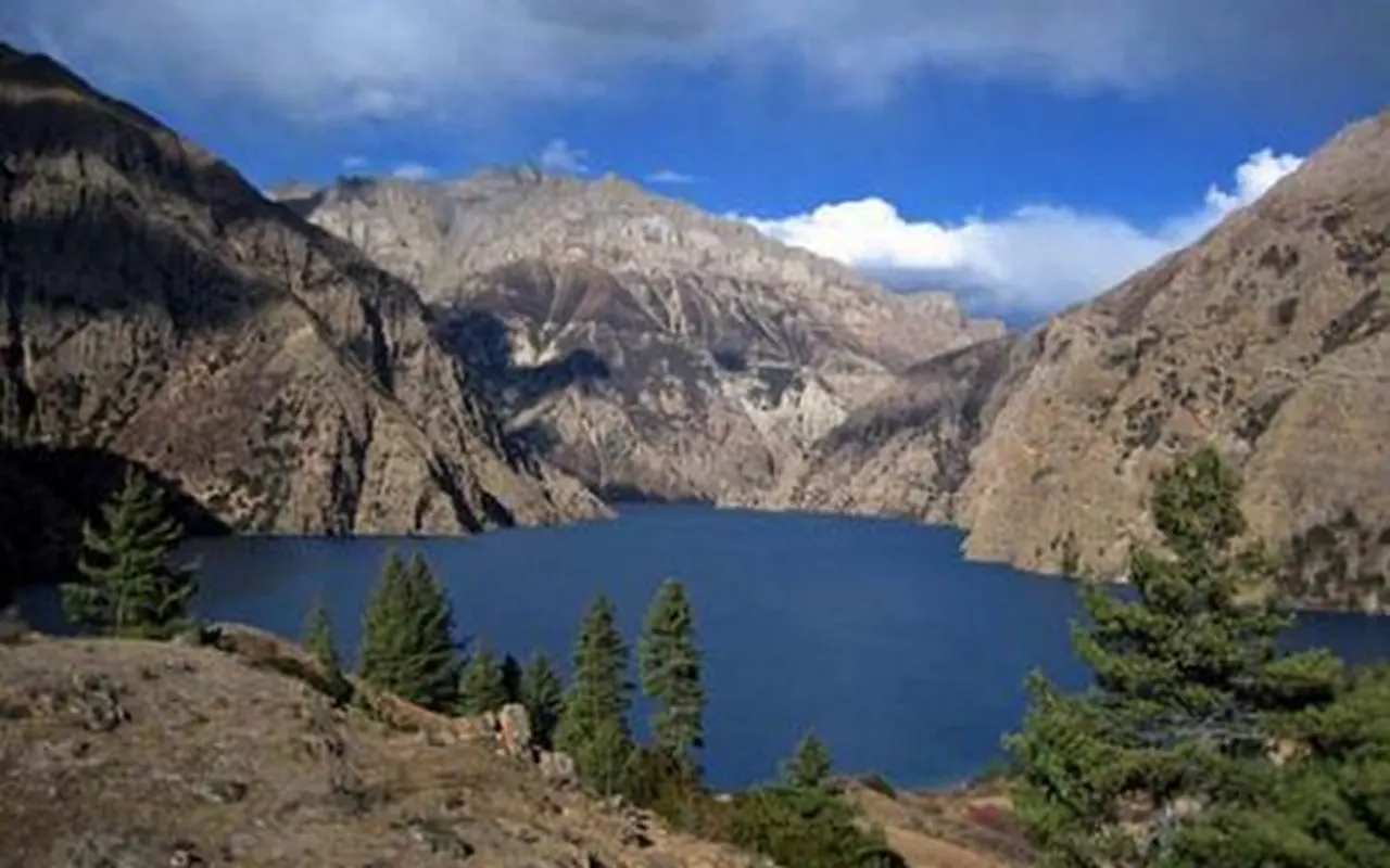
The present-day route will be from Jharana Hotel to Ringmo Village. The path is the next slow climb, and it takes you to a much higher altitude than in the past days. It will take a few hours of walking, and you will gradually be following the trail to where you are heading.
The phase of the trek is further advancement into the mountainous terrain and gets you ready to face the obstacles in the future. There is time to rest and recover after the day’s effort on arrival at the Ringmo Village. This height will be another milestone of the trek.
Activity: 5 to 6 hours Trekking
Max. Altitude: 3,612m/11,850ft. ()
Meal: Breakfast, Lunch and Dinner
Accommodation: Lodge, Teahouse
Today you start at Ringmo and trek to Forest Camp (Silla Ghari). Leaving Ringmo at (3,612 m / 11,850 ft), you will continue to Forest Camp at (3,780 m / 12,402 ft). The path of the day is a moderate rise in altitude and in accordance with the route development according to the planned movement to the higher parts of the path.
You will keep on adapting to the rising altitude as you walk over a number of hours but at a constant speed. Another important part of the trek is the trip to Forest Camp that will get you ready to go on a trek to Kang La Base Camp. Once at Forest Camp, you may take a rest and prepare to go on to the higher levels that lie ahead of you in your days to come.
Activity: 5 to 6 hours Trekking
Max. Altitude: 3,780m/12,402ft. (Forest Camp )
Meal: Breakfast, Lunch and Dinner
Accommodation: Lodge, Teahouse
You will trek today from Forest Camp (Salla Ghari) to Kang La Base Camp. Starting from Forest Camp (3,780 m / 12,402 ft), you will gradually ascend to Kang La Base Camp (4,600 m / 15,092 ft). This is a special day because you are entering into a much higher zone of elevation. The trail is a gradual ascent and takes a day of walking. The feeling of entering a more distant and rougher mountain area is more pronounced with the increase in altitude.
The Kang La Base Camp is a significant milestone in the trek and is a warm-up to the next milestone, the Kang La Pass. Once you get to camp, you will have time to rest and prepare yourself to have one of the most challenging and rewarding days of the trek.
Activity: 6 to 7 hours Trekking
Max. Altitude: 4,600m/15,092ft. (Kang La Base Camp)
Meal: Breakfast, Lunch and Dinner
Accommodation: Tents, Teahouse
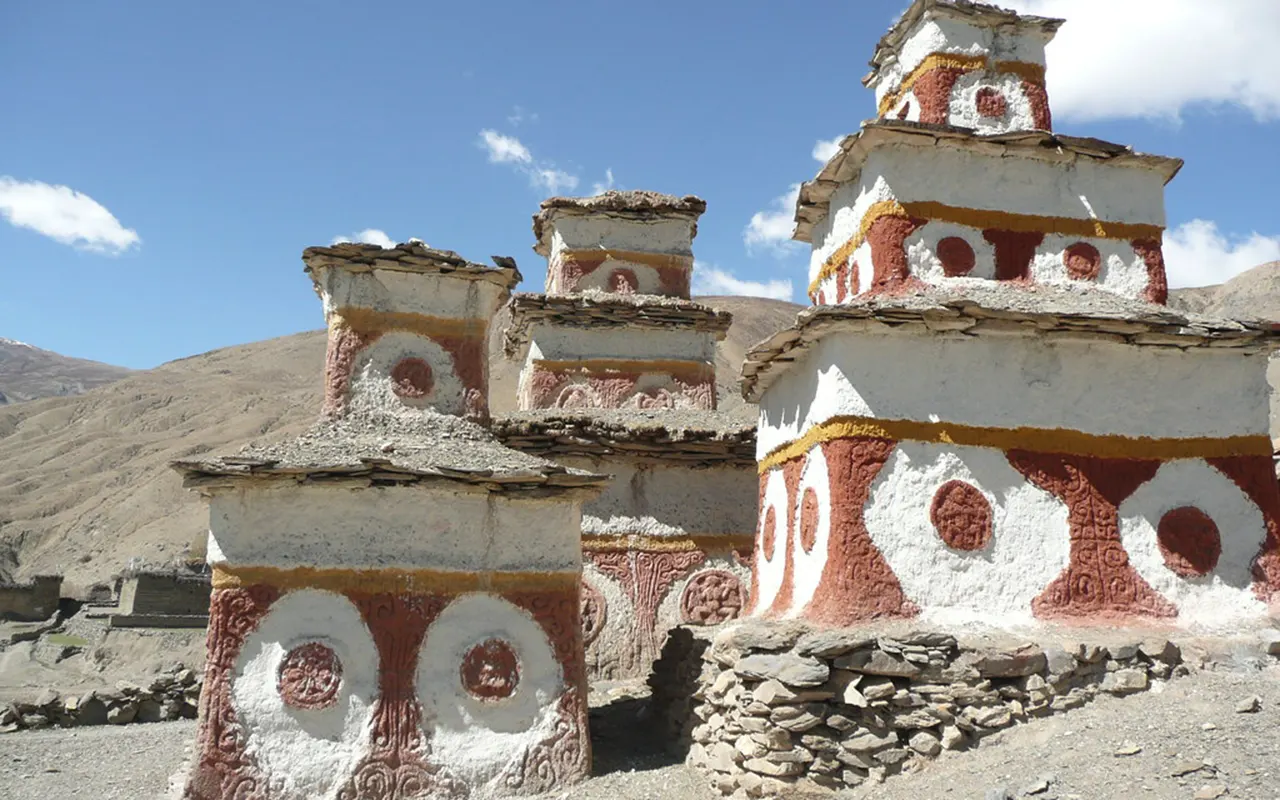
Today you have a path to Kang La Base Camp to Shey Gompa. The day starts with an ascent to Kang La Pass (5360 m / 17585 ft), the highest point of the day, and then descending to Shey Gompa (4400 m / 14364 ft). It is considered one of the most important trekking days in the itinerary as you traverse a large high-altitude pass.
The path will include a challenging ascent and a lengthy fall, so the progress will have to be stable all day long. Attaining Shey Gompa is a big achievement and carries you to a significant spot on the path. You will have a rewarding day on the trail and rest and prepare for the acclimatization day tomorrow.
Activity: 7 to 8 hours Trekking
Max. Altitude: 5,360m/17,585ft. (Shey Gompa)
Meal: Breakfast, Lunch and Dinner
Accommodation: Tents, Teahouse
It is an acclimatization day today in Shey Gompa (4,400 m / 14,436 ft). This day of rest is added to enable your body to adapt to the high altitude, after which you resume in more difficult parts of the trek. An extra day at this altitude helps to make the journey in the future days safer and more comfortable.
The time off allows you to rest after the previous day’s crossing of the pass and to prepare for the next part of the trek. There is even a chance to rest in Shey Gompa and to save energy before going back on the trail. This is a significant day of acclimatization in the overall trekking plan.
Activity: Acclimatization.
Max. Altitude: 4,400m/14,436ft. (Shey Gompa)
Meal: Breakfast, Lunch and Dinner
Accommodation: Tents, Teahouse
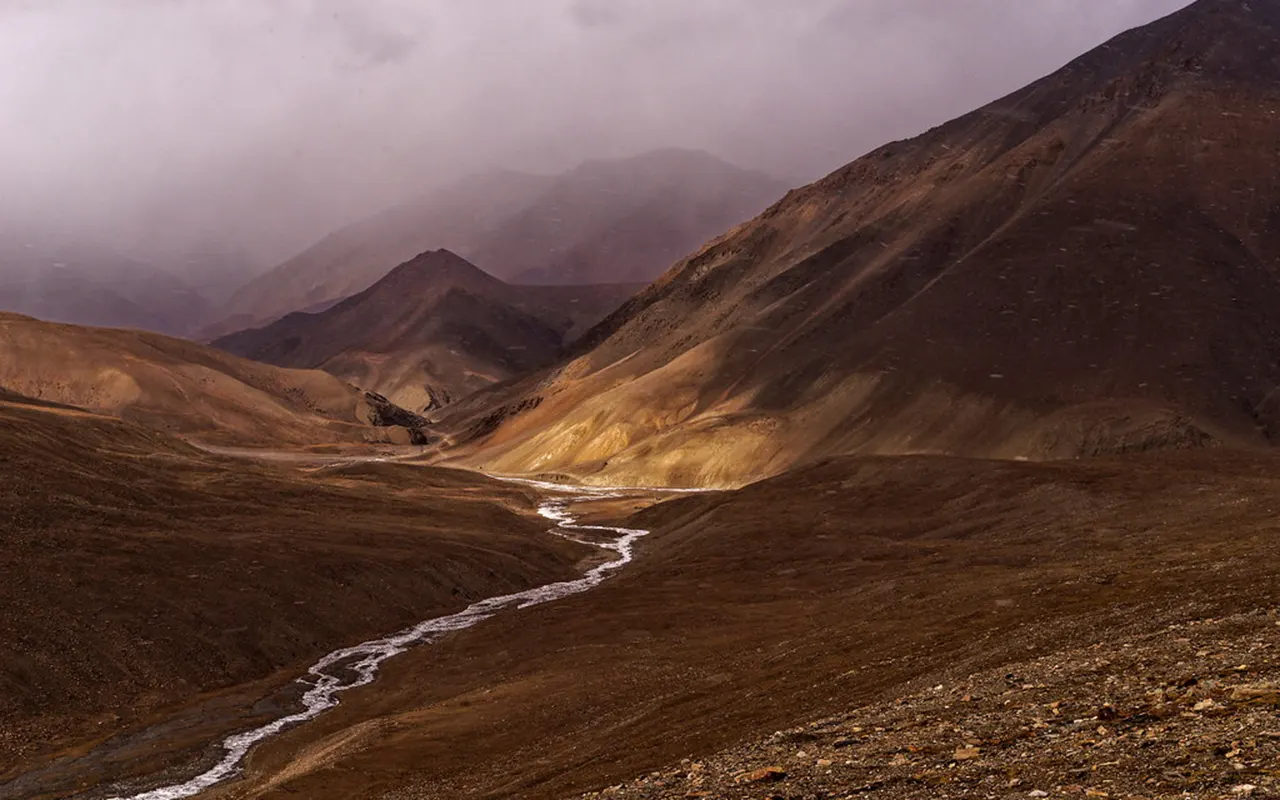
Today you are going to trek a long way from Shey Gompa to Namgung. Beginning at Shey Gompa (4,400 m / 14,436 ft), you will cross Sela Pass (5,010 m / 16,437 ft) before descending to Namgung at (4,430 m / 14,534 ft). The day is a mixture of a high pass crossing and a drop to the next destination. This is another rewarding part of the trek as you go on the trail, because of the upward and downward increase and decrease.
Passing Sila Pass, the route to Namgung is a gradual advancement in the isolated mountainous area. The trip is an extension of the previous experience of acclimatization, and it is a process that is going to be able to prepare you for the next few days on the trail.
Activity: 6 to 7 hours Trekking
Max. Altitude: 5,010m/16,437ft. (Namgung)
Meal: Breakfast, Lunch and Dinner
Accommodation: Lodge, Teahouse
You will trek today from Namgung to Saldang. Leaving Namgung (4,430 m / 14,534 ft), the trail descends to Saldang (3,770 m / 12,369 ft). Following some days of higher elevations, the modern-day journey is a gradual reduction in altitude. The trek is along the fixed route, and it offers a variation in elevation profile compared to the last days of the pass crossing.
By walking a few hours, you will still be progressing steadily through the area. You will arrive at Saldang and can rest and prepare to enter the next stage of the trek. The downward slope also enables your body to rest even as you go on the general journey.
Activity: 5 to 6 hours Trekking
Max. Altitude: 4,430m/14,534ft. (Saldang)
Meal: Breakfast, Lunch and Dinner
Accommodation: Lodge, Teahouse
You start your trek from Saldang to Khoma Gaun. The trail again rises up as the path goes through the elevated parts of the area. The gradual climb will take several hours of hiking and is another significant milestone of the trip.
As you ascend, you keep on advancing to the distant places that were part of the itinerary. On reaching Khoma Gaun, you will be able to relax and get ready to go the next day. The day adds to the slow pace of ascending and descending that define this journey.
Activity: 6 to 7 hours Trekking
Max. Altitude: 4,100m/13,451ft. (Khoma Gaun)
Meal: Breakfast, Lunch and Dinner
Accommodation: Lodge, Teahouse
You will start your trek from Khoma Gaun and continue to Mendo. Beginning at (4,100 m / 13,451 ft), today’s route leads to Mendo at (4,000 m / 13,123 ft). The walk entails a fairly small rise in altitude as compared with some earlier days, and relaxation in forward progress along the path. On the mountain landscape, you will be walking on the outlined itinerary at a comfortable pace.
This step is another bridge on the long path through the region and will be another step toward Tinje Village. Once you have reached Mendo, you will be able to rest and replenish yourself and resume the trek the next day.
Activity: 5 to 6 hours Trekking
Max. Altitude: 4,100m/13,451ft. (Mendo)
Meal: Breakfast, Lunch and Dinner
Accommodation: Lodge, Teahouse
Today, you are going to walk out of Mendo to Tinje Village. Starting from Mendo at (4,000 m / 13,123 ft), you will continue to Tinje Village at (4,180 m / 13,714 ft). The track is along the scheduled pathway and incorporates a slow increase in the altitude of the track as it moves through the elevated mountainous area. The several-hour walk will be at an even pace, and you will be moving further in the remote areas.
This is a significant phase of the entire trek and assists you to take a step forward towards the next high passes. When you arrive at Tinje Village, you have a chance to have a rest and get ready for the following day. The day’s trek provides another rewarding step forward in this long and adventurous route.
Activity: 6 to 7 hours Trekking
Max. Altitude: 4,180m/13,714ft. (Tinje Village)
Meal: Breakfast, Lunch and Dinner
Accommodation: Lodge, Teahouse
Today you trek from Tinje Village to Rapka. Leaving Tinje Village at (4,180 m / 13,714 ft), you will trek to Rapka at (4,535 m / 14,879 ft). The day includes a gradual incline and brings you to a higher level as compared to the preceding night. In going further up the road, the rise in elevation becomes more evident, and it is worthwhile to have a comfortable walk all through the day.
The trail is made in accordance with the intended itinerary and is another chance to ascend at a slow pace. When you arrive at Rapka, you will have time to rest and load the important pass crossing you have planned to make the next day. This step has a significant role to play in the development of the trek.
Activity: 6 to 7 hours Trekking
Max. Altitude: 4,535m/14,879ft. (Tinje Village)
Meal: Breakfast, Lunch and Dinner
Accommodation: Lodge, Teahouse
Today you will trek from Rapka to Chharka Village through Chharka La. Beginning at Rapka (4,535 m / 14,879 ft), you will ascend to Chharka La (5,015 m / 16,453 ft) before descending to Chharka Village (4,110 m / 13,484 ft). It is one of the numerous pass-crossing days of the route and takes a day of trekking.
A trail to the village then follows the climb to the pass, as a rewarding and memorable phase of the journey. The next significant landmark on your way through the remote mountain area is reaching Chharka Village. Once there, you can relax and unwind after a hard day’s work.
Activity: 6 to 7 hours
Max. Altitude: 4,535m/14,879ft. (Rapka)
Meal: Breakfast, Lunch and Dinner
Accommodation: Lodge, Teahouse
Today is an exploration day in Chharka Village (4,110 m / 13,484 ft). This day is a chance to stay in the same place and then resume the trek. An exploration day will also help to break the long trip, and offer more time at this point of the itinerary. The Chharka Village is also a good place to relax and have a preview of the next trek towards Norbulung.
The day has a leisurely routine compared to the intense trekking days preceding and succeeding it. Staying at the same level, you may save your strength and prepare for the following part of the journey.
Activity: Exploration
Max. Altitude: 4,110m/13,484ft. (Chharka Village)
Meal: Breakfast, Lunch and Dinner
Accommodation: Lodge, Teahouse
Today you will trek from Chharka Village to Norbulung. The path is a significant increase in elevation and will lead to another high pass crossing. After a few hours of walking, you will still be following the line of the planned walk, but slowly moving through the mountainous landscape.
This is a significant day in the general ascent as the altitude increases. Having arrived at Norbulung, you may rest and prepare yourself for a difficult stage. The trek is a necessary means to the greater heights which tomorrow awaits us.
Activity: 6 to 7 hours Trekking
Max. Altitude: 4,750m/15,584ft. (Norbulung)
Meal: Breakfast, Lunch and Dinner
Accommodation: Lodge, Teahouse
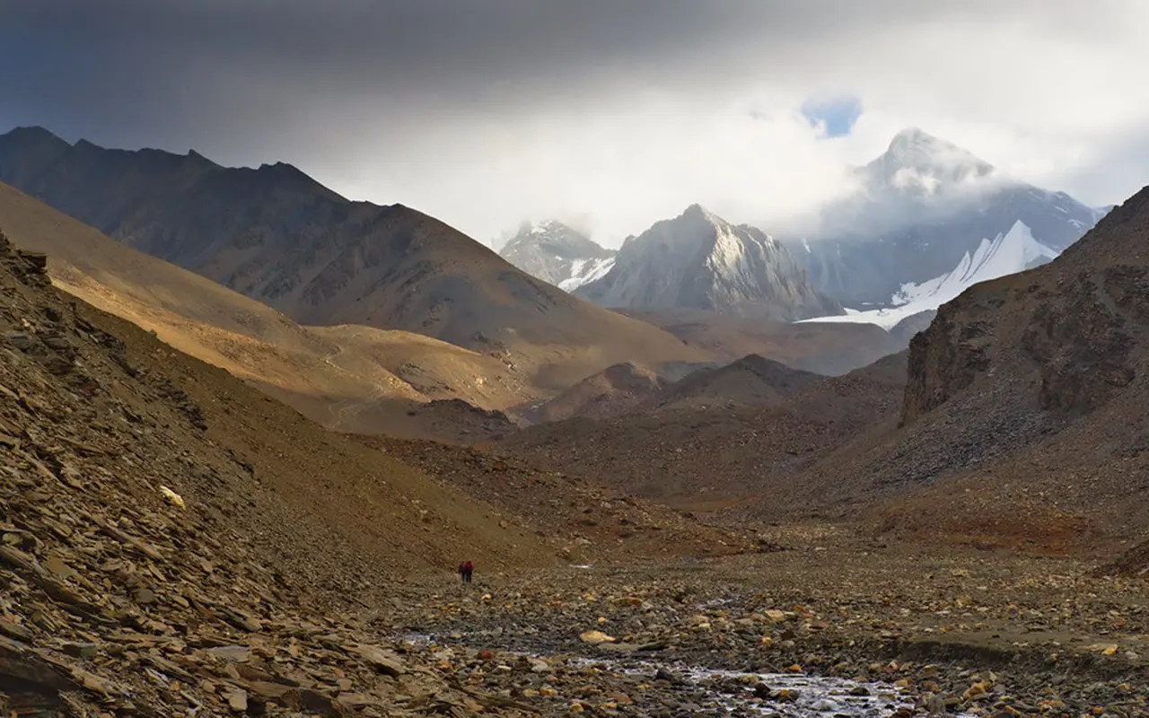
Today you are going to trek from Norbulung to Sangda Phedi. The day begins with an ascent from Norbulung (4,750 m / 15,584 ft) to Higher Sangda La(5,185 m / 17,011 ft), before continuing to Sangda Phedi (5,100 m / 16,732 ft). It is a day of one of the greatest trekking days of the trek and a great accomplishment in the course.
The ascent to the pass is one that has to be done with perseverance. Once you cross the pass, you will proceed to Sangda Phedi, where you will have the night. This is the next big milestone and before the last high pass crossing of the journey.
Activity: 7 to 8 hours Trekking
Max. Altitude: 5,185m/17,011ft. (Sangda Phedi)
Meal: Breakfast, Lunch and Dinner
Accommodation: Lodge, Teahouse
Day 21: Cross Lower Sangda La and Trek to Sangda Village
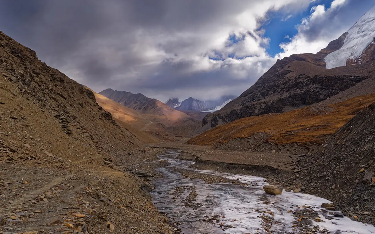
This is the day you will trek from Sangda Phedi to Sangda Village via Lower Sangda La. Starting from Sangda Phedi (5,100 m / 16,732 ft), you will cross Lower Sangda La (5,035 m / 16,519 ft) before descending to Sangda Village (3,800 m / 12,467 ft). The day is a mixture of a final pass crossing the high and a significant descent.
Having been in high place for several days, the route of today slowly brings you downward as we proceed with the journey towards its final stages. The gradual downward spiral needs time and gradual striding. Visiting Sangda Village, you may relax and rest, having made another important day on the trail.
Activity: 6 to 7 hours Trekking
Max. Altitude: 5,100m/16,732ft. (Sangda Village)
Meal: Breakfast, Lunch and Dinner
Accommodation: Lodge, Teahouse
Today you are going to trek from Sangda Village to Pangling. The day entails a great drop as the path steadily sheds the elevated areas behind. The walk will last a few hours and will take you along the intended path as you make gradual strides towards the later parts of the walk. This is due to the fact that the altitude is lower, a fact that offers a significant contrast to the high mountain passes that have been taken so far on the trip.
As you keep on falling, the trek starts to become nearer to its end. When you arrive at Pangling, you are able to have a rest and get ready to trek on the last day to Jomsom. The journey in the modern world is yet another significant step in accomplishing this phenomenal adventure.
Activity: 6 to 7 hours Trekking
Max. Altitude: 3,800m/12,467ft. (Pangling)
Meal: Breakfast, Lunch and Dinner
Accommodation: Lodge, Teahouse
Today you trek from Pangling to Jomsom. It is the last trekking day of the trek and the end of the long overland trek through the mountains. The trail is relatively lower than that of the previous parts of the journey, which makes it possible to enjoyably end the adventure.
Taking a walk over a few hours, you will gradually approach Jomsom. Arriving at your destination is a great accomplishment after days on the trail. When you reach Jomsom, it is possible to feast on the successful completion of the trekking part of the itinerary.
Activity: 7 to 8 hours Trekking
Max. Altitude: 2,900m/9,514ft. (Jomsom)
Meal: Breakfast, Lunch and Dinner
Accommodation: Lodge, Teahouse
Today you are going to fly from Jomsom to Pokhara. This is a short flight that conveniently transfers the mountain region to Pokhara after the trekking adventure. The trip is a transition of the distant trekking regions to one of the major travel centers in Nepal. After several days walking, the flight is a convenient and effective means of proceeding with the itinerary.
On reaching Pokhara, you can unwind and take time to adjust to the pace after the trek. This is a transitional day of travel between the trekking part and the ultimate return to Kathmandu. The adventure is entering its final stage.
Activity: Flight
Max. Altitude: 2,420m/7,940ft. (Pokhara)
Meal: Breakfast, Lunch and Dinner
Accommodation: Hotel
Today, you will end the journey by driving from Pokhara to Kathmandu. The trip will last about six hours and will be the last day of the trip. This is an overland journey after the trek and after visiting the mountain region, as a way of returning to the capital city. You can think about the past few weeks as you head towards Kathmandu and the things you have accomplished.
The official trip to Kathmandu will end the trek and the entire itinerary. As the adventure is now complete, the memories of the trek, high passes, villages, and mountain scenery will be remembered forever as the highlights of this great adventure in Nepal.
Activity: 6 hours Drive
Max. Altitude: 1,400m/4,593ft. (Kathmandu)
Meal: Breakfast, Lunch and Dinner
Accommodation: Hotel
Note:
If you have a private group and prefer a personalized experience, we can organize a custom trip tailored to your requirements and group size, running it any day you choose.
Transportation
Food and Accommodation
Guide and Support Staff
Permits and Expenses
Medical and Gear
Others
International Flights and Visa
Food and Accommodation
Travel and Medical Insurance
Other Expenses
Internet, charging and laundry charges
The Upper Dolpo Trek is in one of the most remote areas of the Himalayas in Nepal, and weather conditions are a significant factor in the entire trekking experience. The spring (March to May) and autumn (September to November) are the most suitable seasons to go on this adventure. These months are usually more comfortable, the weather is usually clearer, and trekking conditions are better. As Upper Dolpo is a rain-shadow region, it does not get a lot of rain compared to other trekking destinations in Nepal.
There are numerous weather conditions that trekkers can anticipate as the trail winds its way up and down mountain passes at high altitudes above 5,000 m / 16,404 ft. At high altitudes, conditions may vary rapidly, and hence it is worthwhile preparing. Adherence to a well-designed Upper Dolpo Trek itinerary in the suggested seasons can be used to optimize safety, comfort, and enjoyment during the trip.
The Upper Dolpo Trek is regarded as a difficult trek that is fit to be attempted by the trekkers who are physically fit and have some prior experience in hiking. The trail includes many long foot days, wild forest, and a number of mountain passes. Trekkers spend several days at high elevation (4,000 m / 13,123 ft), so it is a significant aspect. In contrast to well-known trekking trails with all the facilities, the Dolpo Upper is remote and requires more independence. This trek is more challenging than most other treks in the Himalayas due to the combination of altitude, time, and remote conditions.
Nevertheless, adequate planning, a slow acclimatization process, and skilled support personnel make the process manageable. With a well-planned Upper Dolpo Trek trip, logistical support, permits, transportation, and highly experienced guides, the trekkers are able to concentrate on the breathtaking scenery and cultural experience as they safely finish this difficult journey.
One of the most crucial factors in the Upper Dolpo Trek is altitude sickness. The path goes across a few high passes with some areas over 5,000 m / 16,404 ft), where the chances of symptoms related to altitude rise. It can manifest itself in common symptoms such as headache, fatigue, dizziness, loss of appetite, and disturbed sleep. Gradual ascent, adequate hydration, rest, and adherence to a well-planned itinerary would be the best way to mitigate the risk. Most trekking programs also involve acclimatization days, which are meant to allow the body time to acclimate to higher altitudes.
Trekkers must never ignore any symptoms by informing the guide and should not overexert themselves at high altitude. By opting to go with an Upper Dolpo Trek package that includes seasoned guides and a detailed Upper Dolpo Trek itinerary, safety is greatly enhanced and assists in making the trekking process a comfortable one as the trip progresses.
Whether to have an Upper Dolpo Trek or not, good preparation is the key to success. Trekkers ought to engage in physical training a few weeks or months before the trek since the trek requires longer days of walking and higher altitude. Endurance and general fitness can be enhanced by regular exercise like hiking, walking, jogging, cycling, and stair climbing. It is especially important to strengthen leg muscles and enhance cardiovascular fitness. Mental training is also a very critical aspect since the trek is in an isolated setting where amenities are minimal.
Trekkers must also get used to the simple trekking gear and high-altitude travel necessities. The carefully designed Upper Dolpo Trek itinerary will provide gradual acclimatization and minimize physical overstrain. Through good planning, expectations, and professional guidance by 3A Adventure, trekkers can be assured that they will be able to appreciate this fantastic Himalayan adventure and its special culture and nature.
The food and accommodation on the Upper Dolpo Trek are usually basic and to suit the requirements of the trekkers going through the mountainous areas. Food is usually centered on giving the body energy and nutrition on the long trekking days. The offered menu can be less than in the popular trekking destinations in Nepal because of the remoteness of the area. The accommodations are typically simple but offer the much-needed protection and sleep following a day on the trail. Once the route gets to more isolated places, the facilities get easier.
Trekkers can expect an adventure of a classic mountain trekking experience, as opposed to luxury services. An organized Upper Dolpo Trek tour package will be helpful to ensure that food, accommodation, and logistics are organized effectively during the trip. By realizing these conditions prior to the trip, trekkers can enjoy the real essence of the Upper Dolpo.
The Upper Dolpo Trek includes a significant element of transportation since the area is a remote region of western Nepal. The trip is usually accompanied by flights in the country and hiking. Flights assist in linking the major cities to the trekking region and save a lot of time. Sometimes weather conditions may influence flight schedules in mountainous regions; hence, flexibility is of the essence. After the aerial part is accomplished, walking emerges as the main means of transport during the trip.
Most of the route is inaccessible by road, and so much of Upper Dolpo can only be reached by walking. A well-structured package of Upper Dolpo Trek offers transport service as a part of the whole service. A well-thought-out Upper Dolpo Trek itinerary can assist in guaranteeing travel connectivity and effective transportation during the trek.
During the Upper Dolpo Trek, communication facilities are limited because it is a remote area. In contrast to the more well-known trekking sites, there are fewer communication services in Upper Dolpo, and a lack of network coverage is possible in most parts of the trail. Internet connectivity is not always available or satisfactory in the remote villages, and mobile networks are irregular. Trekkers must be ready to spend some time with no communication with relatives and friends. Before embarking on the trek, it is also quite good to advise loved ones about potential communication lapses.
The trekking personnel and guides are trained in the management of treks in the wilderness and can be helpful in cases of need. Among the peculiarities of the Upper Dolpo Trek, there is a possibility to forget everyday life and live in the world of nature to the full extent. With adequate preparation, trekkers can have a good time and not be bothered by inadequate communication facilities.
The Upper Dolpo Trek needs special permits. Trekkers are required to get the required trekking permits like Upper Dolpo Restricted Area Permit, Shey Phoksundo National Park Entry Permit and TIMS Card (if applicable under current regulations) prior to entering the area. These permits assist in controlling tourism, preserving the local culture, and assisting in conservation in the region.
The requirements when it comes to permits may also evolve with time, and therefore, one should check the existing regulations before traveling. The majority of trekkers opt to use an organized Upper Dolpo Trek package since obtaining the permits may be complicated and requires the appropriate documentation.
Trekking agencies tend to help with the procedures and get all the necessary permits before departure. It is necessary to carry valid permits during the trek since the checks on the permits can be conducted at any stage of the trek. Proper documentation will assist in having a hassle-free and easy trekking experience in Upper Dolpo.
The majority of foreign tourists who visit Nepal to do the Upper Dolpo Trek will require a tourist visa. Nepal also has tourist visas for different lengths of time, and visitors are given ample time to accomplish lengthy treks. Travelers must have a passport that is in good condition with the necessary number of blank pages to stamp their visas. Visa policies and charges can vary, and it is advisable to inquire about the most current information before traveling.
The duration of the Upper Dolpo Trek itinerary is slightly longer than most other trekking paths and, therefore, visitors ought to choose a visa time frame that includes the entire trip, arrival and departure days. Travelling with the right visa before arrival or upon arrival will help avoid complications with travel. Effective travel paperwork would mean that trekkers do not have to worry about the formalities of their trek but enjoy the adventure.
Anyone who is a part of the Upper Dolpo Trek is highly advised to take travel insurance. The high-altitude environment and distant places, combined with a long period of the trek, make full insurance coverage essential during the trip. The policy should be selected by the trekkers such that it encompasses high-altitude trekking coverage, emergency medical care, and evacuation services where necessary.
The route goes through altitudes of more than (5,000 m / 16,404 ft) and therefore insurance must specifically include trekking at such altitudes. Before purchasing a policy, it is important to carefully review the coverage details and exclusions. Bringing evidence of insurance may also prove beneficial on the trip. A good insurance policy gives one a sense of security, and the trekkers can enjoy the moment knowing that they are not alone and there will be someone to come to their rescue in case they are caught up in some unforeseen circumstances during the trek.
Although most of the services are accommodated in an Upper Dolpo Trek package, trekkers are advised to allocate some funds towards personal expenditures on the trek. Additional expenses might be beverages, snacks, personal equipment, laundry (where applicable), charging electronic devices, communication services, and guide and support staff tips. The spending habits of individuals are different, and as a result, the amount needed will differ between travelers.
It is always advisable to have a little cash on hand in case of a sudden need or desire to buy something. As the banking facility and electronic payment options might be unavailable in remote parts, trekkers need to plan it out in advance before visiting the region. The knowledge of possible other costs can also assist the travellers to plan their funds better and spend the trip without having to worry about money. Well-planned travel will help to make it easier and more comfortable.
Upper Dolpo Trek could be undertaken either as a group trek or a personal trek, based on individual desires and travel objectives. A private trek is more flexible and is a more personalized experience as the trekkers are able to bring their own companions and have a personalized schedule where possible. Group treks offer the chance to share the adventure with fellow travellers, and tend to offer a social and supportive atmosphere during the trip. The two options share an itinerary of the Upper Dolpo Trek and come with the required permits, logistics and trekking arrangements.
The option will be based on factors like budget, style of preferred travelling and the size of the group. Trekking in private or in a group, the trekkers have an opportunity to enjoy the amazing landscape, culture, and the remote mountain setting that makes Upper Dolpo one of the most unique trekking locations in Nepal.
General
The Upper Dolpo Trek is a remote trekking experience in western Nepal that is characterized by its secluded scenery, high mountain passes, ancient culture and distinct Himalayan landscapes.
The duration of most of the Upper Dolpo Trek itineraries is between three and four weeks depending on the route and timeline.
Preparation & Fitness
It is advisable to be physically fit as the trek will have long walking days, a high-altitude environment and the terrain will be rough.
Hiking, walking, running, cycling and endurance training are all good to do before the trek.
![]() Insurance & Visa
Insurance & Visa
A majority of international tourists need a tourist visa to enter Nepal.
Yes. High-altitude trekking and emergency evacuation travel insurance is highly recommended.
![]() Guides & Support Staff
Guides & Support Staff
Yes. It is a closed trekking region, and the trekkers are usually obligated to go along with licensed guides.
Yes. Most packages of Upper Dolpo Trek have the option of a porter service to assist in carrying trekking gear.
![]() Accommodation and Facilities
Accommodation and Facilities
The accommodation is usually easy and simple and this is a depiction of the distant character of the Upper Dolpo.
In remote areas there may not be any electricity and where there is, facilities are usually scarce.
![]() Weather & Seasons
Weather & Seasons
The best seasons to trek are generally spring (March to May) and autumn (September to November).
Yes. Weather conditions are subject to rapid changes in higher regions (greater than 4,000 m / 13,123 ft).
![]() Health & Safety
Health & Safety
Yes. As the path is above 5,000 m / 16,404 ft, acclimatization is highly necessary.
Adhere to the itinerary, keep hydrated, maintain a moderate pace and give sufficient rest for acclimatization.
![]() Booking & Payment
Booking & Payment
It is advisable to reserve a few months beforehand in the prime trekking seasons.
![]() Transportation & Flight
Transportation & Flight
The trip usually includes domestic flights and transportation followed by the start of the trekking part.
Yes. Certain weather conditions in mountain areas are known to impact flight schedules.
